Area Overview for RG42 2DS
Photos of RG42 2DS
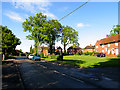
58 photos from this area
Area Information
Key information about the RG42 2DS including its size, population, and administrative classification.
- Area Type
- Postcode
- Area Size
- 8350 m²
- Population
- 1666
- Population Density
- 5517 people/km²
House Prices in RG42 2DS
25
Properties
£280,583
Average Sold Price
£96,000
Lowest Price
£430,000
Highest Price
Showing 25 properties
| Address | Type | Beds | Baths | Last Sale Price | Last Sale Date | |
|---|---|---|---|---|---|---|
| 3 Birchetts Close, Bracknell, RG42 2DS | Terraced | 3 | 1 | £400,000 | Feb 2024 | |
| 18 Birchetts Close, Bracknell, RG42 2DS | Terraced | 3 | 1 | £331,000 | Mar 2022 | |
| 11 Birchetts Close, Bracknell, RG42 2DS | house | - | - | £310,000 | Mar 2021 | |
| 7 Birchetts Close, Bracknell, RG42 2DS | Terraced | 4 | 1 | £430,000 | Feb 2019 | |
| 1 Birchetts Close, Bracknell, RG42 2DS | Terraced | 4 | 3 | £345,000 | Dec 2018 | |
| 17 Birchetts Close, Bracknell, RG42 2DS | Terraced | 2 | 1 | £258,000 | Dec 2018 | |
| 26 Birchetts Close, Bracknell, RG42 2DS | Semi-detached | 2 | - | £246,000 | Jun 2018 | |
| 24 Birchetts Close, Bracknell, RG42 2DS | Terraced | 3 | 1 | £315,000 | Aug 2017 | |
| 20 Birchetts Close, Bracknell, RG42 2DS | house | 2 | - | £291,000 | Nov 2016 | |
| 21 Birchetts Close, Bracknell, RG42 2DS | Terraced | 3 | - | £175,000 | May 2012 |
Page 1 of 3
Energy Efficiency in RG42 2DS
Amenities
Schools
| Rank | School | Type | Entry gender | Ages |
|---|
Explore more schools in this area
Go to Schools tabDemographics
Household Size
Family (3-5 people)
most common
Accommodation Type
Houses
most common
Tenure
52
majority
Ethnic Group
White
most common
Religion
N/A
most common
Household Composition
N/A
most common
Age
47
median
Adults (30-64 years)
most common
Household Deprivation
N/A
with no deprivation
NS-SEC
30
in Lower managerial occupations
Explore more demographic insights in this area
Go to Demographics tabPlanning
Planning Constraints
- Flood RiskPremium
- Ramsar Wetland SitesPremium
- Area of Outstanding Natural BeautyPremium
- Protected Nature ReservePremium
- Protected WoodlandPremium