Area Overview for RG42 1SD
Photos of RG42 1SD
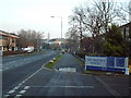
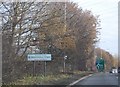
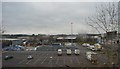
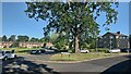
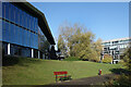
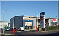
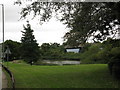
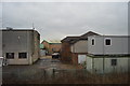
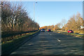
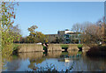
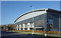
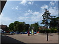
12 photos from this area
Area Information
Key information about the RG42 1SD including its size, population, and administrative classification.
- Area Type
- Postcode
- Area Size
- 1.5 hectares
- Population
- 1652
- Population Density
- 5099 people/km²
House Prices in RG42 1SD
38
Properties
£266,625
Average Sold Price
£82,500
Lowest Price
£435,000
Highest Price
Showing 38 properties
| Address | Type | Beds | Baths | Last Sale Price | Last Sale Date | |
|---|---|---|---|---|---|---|
| 13 Farm Close, Bracknell, RG42 1SD | Terraced | 3 | 1 | £390,000 | Mar 2025 | |
| 3 Farm Close, Bracknell, RG42 1SD | Terraced | 3 | 1 | £387,000 | Mar 2024 | |
| 32 Farm Close, Bracknell, RG42 1SD | Terraced | 2 | 1 | £357,500 | Mar 2024 | |
| 38 Farm Close, Bracknell, RG42 1SD | Terraced | 3 | 1 | £435,000 | Jan 2023 | |
| 8 Farm Close, Bracknell, RG42 1SD | Semi-detached | 3 | 1 | £385,000 | Apr 2017 | |
| 28 Farm Close, Bracknell, RG42 1SD | Terraced | 4 | - | £250,000 | Feb 2015 | |
| 7 Farm Close, Bracknell, RG42 1SD | Terraced | 3 | - | £220,000 | Mar 2013 | |
| 35 Farm Close, Bracknell, RG42 1SD | house | 4 | - | £235,000 | Apr 2010 | |
| 27 Farm Close, Bracknell, RG42 1SD | Terraced | - | - | £168,500 | Jul 2006 | |
| 24 Farm Close, Bracknell, RG42 1SD | house | 3 | - | £171,000 | Oct 2005 |
Page 1 of 4
Energy Efficiency in RG42 1SD
Amenities
Schools
| Rank | School | Type | Entry gender | Ages |
|---|
Explore more schools in this area
Go to Schools tabDemographics
Household Size
Family (3-5 people)
most common
Accommodation Type
Houses
most common
Tenure
53
majority
Ethnic Group
White
most common
Religion
N/A
most common
Household Composition
N/A
most common
Age
47
median
Adults (30-64 years)
most common
Household Deprivation
N/A
with no deprivation
NS-SEC
28
in Lower managerial occupations
Explore more demographic insights in this area
Go to Demographics tabPlanning
Planning Constraints
- Flood RiskPremium
- Ramsar Wetland SitesPremium
- Area of Outstanding Natural BeautyPremium
- Protected Nature ReservePremium
- Protected WoodlandPremium