Area Overview for RG41 5DF
Photos of RG41 5DF
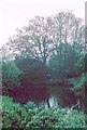
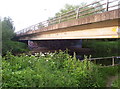
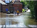
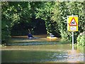
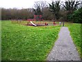
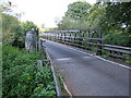

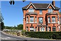
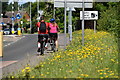
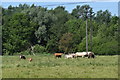
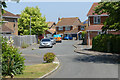
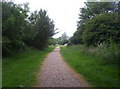
29 photos from this area
Area Information
Key information about the RG41 5DF including its size, population, and administrative classification.
- Area Type
- Postcode
- Area Size
- 29.4 hectares
- Population
- 1833
- Population Density
- 1664 people/km²
House Prices in RG41 5DF
26
Properties
£553,833
Average Sold Price
£200,000
Lowest Price
£820,000
Highest Price
Showing 26 properties
| Address | Type | Beds | Baths | Last Sale Price | Last Sale Date | |
|---|---|---|---|---|---|---|
| Firdale, Mill Lane, Sindlesham, RG41 5DF | Land | 3 | 1 | £410,000 | Jul 2025 | |
| Monsoon, Mill Lane, Sindlesham, RG41 5DF | Detached | 5 | 3 | £800,000 | May 2024 | |
| 2, Rose Cottages, Mill Lane, Sindlesham, RG41 5DF | house | - | - | £525,000 | Feb 2023 | |
| Orchard House, Mill Lane, Sindlesham, RG41 5DF | house | - | - | £769,500 | Jun 2021 | |
| Avenue House, Mill Lane, Sindlesham, RG41 5DF | house | - | - | £820,000 | May 2019 | |
| Oakview, Mill Lane, Sindlesham, RG41 5DF | Detached | 5 | 4 | £200,000 | Nov 2018 | |
| The Garden Cottage, Mill Lane, Sindlesham, RG41 5DF | Detached | 2 | - | £420,000 | Jul 2013 | |
| Fyrish, Mill Lane, Sindlesham, RG41 5DF | Retail | 3 | 2 | £540,000 | May 2010 | |
| The Evergreens, Mill Lane, Sindlesham, RG41 5DF | Detached | - | - | £500,000 | Jan 2010 | |
| Bay Trees, Mill Lane, Sindlesham, RG41 5DF | Detached | 4 | 3 | - | - |
Page 1 of 3
Energy Efficiency in RG41 5DF
Amenities
Schools
| Rank | School | Type | Entry gender | Ages |
|---|
Explore more schools in this area
Go to Schools tabDemographics
Household Size
Family (3-5 people)
most common
Accommodation Type
Houses
most common
Tenure
75
majority
Ethnic Group
White
most common
Religion
N/A
most common
Household Composition
N/A
most common
Age
47
median
Adults (30-64 years)
most common
Household Deprivation
N/A
with no deprivation
NS-SEC
52
in Lower managerial occupations
Explore more demographic insights in this area
Go to Demographics tabPlanning
Planning Constraints
- Flood RiskPremium
- Ramsar Wetland SitesPremium
- Area of Outstanding Natural BeautyPremium
- Protected Nature ReservePremium
- Protected WoodlandPremium