Area Overview for RG41 2RA
Photos of RG41 2RA
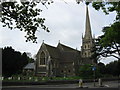

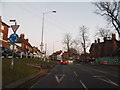
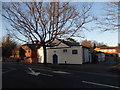
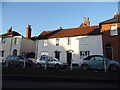
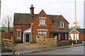
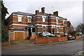
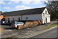
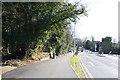

100 photos from this area
Area Information
Key information about the RG41 2RA including its size, population, and administrative classification.
- Area Type
- Postcode
- Area Size
- 1.0 hectares
- Population
- 2131
- Population Density
- 4124 people/km²
House Prices in RG41 2RA
32
Properties
£276,132
Average Sold Price
£160,950
Lowest Price
£436,000
Highest Price
Showing 32 properties
| Address | Type | Beds | Baths | Last Sale Price | Last Sale Date | |
|---|---|---|---|---|---|---|
| 9 Ormonde Road, Wokingham, RG41 2RA | Flat | - | - | £195,000 | Dec 2024 | |
| 57 Ormonde Road, Wokingham, RG41 2RA | house | 2 | 1 | £315,000 | May 2023 | |
| 43 Ormonde Road, Wokingham, RG41 2RA | house | 4 | 1 | £436,000 | Nov 2022 | |
| 47 Ormonde Road, Wokingham, RG41 2RA | house | - | - | £376,000 | Aug 2021 | |
| 19 Ormonde Road, Wokingham, RG41 2RA | Maisonette | 4 | - | £265,000 | May 2018 | |
| 39 Ormonde Road, Wokingham, RG41 2RA | Terraced | 3 | - | £315,500 | Dec 2017 | |
| 15 Ormonde Road, Wokingham, RG41 2RA | Maisonette | 3 | 1 | £240,000 | Jan 2016 | |
| 61 Ormonde Road, Wokingham, RG41 2RA | Terraced | 3 | 2 | £297,000 | Jun 2015 | |
| 59 Ormonde Road, Wokingham, RG41 2RA | house | 2 | - | £265,000 | Aug 2014 | |
| 27 Ormonde Road, Wokingham, RG41 2RA | house | - | - | £172,000 | Dec 2005 |
Page 1 of 4
Energy Efficiency in RG41 2RA
Amenities
Schools
| Rank | School | Type | Entry gender | Ages |
|---|
Explore more schools in this area
Go to Schools tabDemographics
Household Size
One person
most common
Accommodation Type
Houses
most common
Tenure
56
majority
Ethnic Group
White
most common
Religion
N/A
most common
Household Composition
N/A
most common
Age
47
median
Adults (30-64 years)
most common
Household Deprivation
N/A
with no deprivation
NS-SEC
45
in Lower managerial occupations
Explore more demographic insights in this area
Go to Demographics tabPlanning
Planning Constraints
- Flood RiskPremium
- Ramsar Wetland SitesPremium
- Area of Outstanding Natural BeautyPremium
- Protected Nature ReservePremium
- Protected WoodlandPremium