Area Overview for RG40 5QE
Photos of RG40 5QE


Area Information
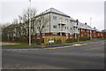
RG40 5QE is a specific postcode area covering a small residential cluster of 14.2 hectares. The population here stands at 1853 people, creating a tight-knit community rather than a sprawling suburb. With a density of 13008 people per square kilometre, the area feels occupied without being overcrowded. This level of concentration typically results in quieter streets where residents know their neighbours, making it suitable for those who prefer a settled domestic environment over urban anonymity. The location is fixed within England, offering a distinct residential identity separate from the wider region. Living in RG40 5QE means accessing a defined space where boundaries are clear and the community scale is manageable. You will find yourself in a setting that prioritises housing over commercial sprawl, as the description highlights its nature as a residential focus. The area is small enough that daily needs are often a short walk or drive away, yet it maintains the privacy expected of a dedicated home cluster. This specific postcode represents a realistic slice of English suburban life, balancing proximity with space for a family to grow and establish roots in a permanent home.
- Area Type
- Postcode
- Area Size
- 14.2 hectares
- Population
- 1853
- Population Density
- 2882 people/km²
The housing stock in RG40 5QE is characterised by a single accommodation type: houses. This uniformity means buyers will not encounter a mix of high-rise apartments or landed estates of varying scales; every property fits the traditional British residential model. With 69% of households owned, the area is overwhelmingly owner-occupied rather than a rental market. This high ownership rate suggests a stable market where residents plan to stay for the long term, likely resulting in well-maintained properties with a strong sense of care from current owners. For buyers looking at this small area and its immediate surroundings, the market consists of family homes designed for private enjoyment rather than shared living spaces. The lack of flats eliminates the challenges associated with block management or communal areas, appealing to those who value complete autonomy over their living space. Understanding the nature of this stock is crucial because it dictates the type of neighbourhood you will step into. Whether you are looking for a sustainable investment or a place to settle down, the data confirms that RG40 5QE is built around the concept of the house, not the block. This makes it a predictable environment for anyone evaluating the property market in this specific postcode sector.
House Prices in RG40 5QE
Showing 5 properties
| Address | Type | Beds | Baths | Last Sale Price | Last Sale Date | |
|---|---|---|---|---|---|---|
| The Grange, Bell Foundry Lane, Wokingham, RG40 5QE | Detached | 4 | 3 | £778,996 | Mar 2024 | |
| 1 Bell Foundry Lane, Wokingham, RG40 5QE | Semi-detached | 3 | 1 | £375,000 | Jul 2022 | |
| Ashridge Close, Bell Foundry Lane, Wokingham, RG40 5QE | Detached | 7 | 4 | £825,000 | Mar 2022 | |
| 2 Bell Foundry Lane, Wokingham, RG40 5QE | house | - | - | £198,000 | Sep 2004 | |
| Annexe, Ashridge Close, Bell Foundry Lane, Wokingham, RG40 5QE | Flat | - | - | - | - |
Energy Efficiency in RG40 5QE
Living in RG40 5QE places you within practical reach of several key amenities that support a practical, independent lifestyle. Retail options include Co-op Matthews, Sainsburys Wokingham, and Waitrose Wokingham. These three locations offer a mix of general groceries and premium shopping, allowing you to purchase everyday essentials alongside higher-quality goods without travelling far. For transport, residents are close to Wokingham Railway Station, Winnersh Railway Station, and Winnersh Triangle Railway Station. These five nearby rail links provide access to the wider network, facilitating daily commutes to Oxford, Reading, or London when necessary. The presence of these specific venues means you do not rely on a car for all journeys, though the local cluster is designed for home life. Dining, parks, and leisure facilities are accessed through these nearby hubs, creating a convenient loop for your weekly routine. You will find that daily life here is structured around reliable access to shops and trains, removing the frustration of long commutes or closed-down high streets. The immediate vicinity is equipped to handle the needs of a working family or a professional seeking a calm base with nearby conveniences.
Amenities
Schools
| Rank | School | Type | Entry gender | Ages |
|---|
Explore more schools in this area
Go to Schools tabDemographics
The community in RG40 5QE is defined by an older demographic profile, with a median age of 47 years. Most residents fall into the adult age range between 30 and 64 years, suggesting a population made up of established families or empty nesters rather than young professionals or retirees. This age distribution is reflected in the accommodation type, which consists entirely of houses. There are no flats or apartments in this specific cluster, reinforcing its character as a family-oriented zone built for detached or semi-detached living. Home ownership is high, standing at 69% of households. This figure indicates that the vast majority of residents live in properties they own outright or are paying off through a mortgage. The area is predominantly White, aligning with the broader English demographic patterns found in similar residential districts. The absence of shared housing blocks and the high ownership rate point to a stable, long-term settlement where people invest in their immediate surroundings. This profile contrasts with temporary rental markets or student-heavy zones, offering a sense of permanence and investment stability for anyone considering homes in RG40 5QE.
Household Size
Accommodation Type
Tenure
Ethnic Group
Religion
Household Composition
Age
Household Deprivation
NS-SEC
Explore more demographic insights in this area
Go to Demographics tabPlanning
Planning Constraints
- Flood RiskPremium
- Ramsar Wetland SitesPremium
- Area of Outstanding Natural BeautyPremium
- Protected Nature ReservePremium
- Protected WoodlandPremium