Area Overview for RG40 4AE
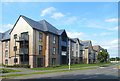
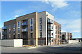
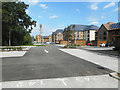
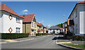
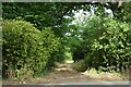
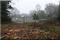
Photos of RG40 4AE

Area Information
Living in RG40 4AE offers a defined residential experience within a specificpostcode cluster of just 4946 square metres. Yet, this small footprint supports a population of 3322 people, creating a dense community feel that is unusual for such a compact zone. The area exists in England alongside other postcodes in the RG40 region, yet its specific boundaries define a unique micro-location for residents. You will find yourself in an environment where every neighbour is likely known, given the high concentration of homes in such a confined space. This postcode covers a residential cluster where daily life revolves closely around the immediate surroundings, fostering a sense of belonging that is often diluted in larger, more spread-out districts. The proximity of residents to one another creates a tight-knit atmosphere, though the small size of the area means you cannot wander far from central points within the postcode. For anyone considering homes in RG40 4AE, the reality is that the neighbourhood is intimate and immediately accessible, removing the need for long commutes to local facilities. The population density reinforces this character, ensuring that services and community interactions are always within reach.
- Area Type
- Postcode
- Area Size
- 4946 m²
- Population
- 3322
- Population Density
- 404 people/km²
Homes in RG40 4AE represent a distinct segment of the housing market due to the overwhelming preference for standalone properties. The data indicates that houses are the standard accommodation type, which means you will rarely find conversion flats or modern high-rise blocks in this specific cluster. With 77% of the population owning their homes, the local market is driven by owner-occupiers rather than investors or the private letting sector. This statistic signals that the purchase price for a property here often comes with strong mortgage equity from previous buyers, stabilising the local supply. If you are looking to buy, you are entering an area where resale markets tend to be steady because most neighbours have a vested long-term interest in raising property values. The small size of the postcode, covering only 4946 square metres, implies that inventory moves relatively quickly, as there are limited units available for exchange. Buying a home in RG40 4AE means securing a property within a very tight radius, which enhances the convenience of daily life but restricts choice. The high ownership percentage also suggests that landlords are less common, meaning tenant issues are less of a concern for sellers and potential buyers.
House Prices in RG40 4AE
No properties found in this postcode.
Energy Efficiency in RG40 4AE
Daily life in RG40 4AE benefits from a network of amenities within practical reach, ensuring convenience without the need to travel far. Residents can access five retail outlets, including Co-op Arborfield, Co-op Finchampstead, and Co-op Former for everyday shopping needs. Transport links are equally well developed, with five rail stations serving the broader area, including Wokingham Railway Station, Crowthorne Railway Station, and Winnersh Railway Station. This rail access provides easy connectivity to wider road networks and London for commuters. Additionally, Blackbushe Airport is located nearby, offering travel flexibility for those requiring regional or private aviation services. The presence of multiple Co-op stores ensures that basic food and household requirements are met without long queues or distant trips. You do not need to venture into larger towns for routine errands, as the local retail provision is sufficient for weekly shopping. The combination of rail options and retail venues creates a self-sufficient environment where essential services are integrated into the local fabric of RG40 4AE.
Amenities
Schools
Families living in RG40 4AE have convenient access to two primary schools with recognised quality standards. Gorse Ride Junior School holds an Ofsted rating of good, offering education to children moving beyond the infant years. Meanwhile, Gorse Ride Infants' School also carries a good Ofsted rating, providing early years education for younger pupils. Both schools are situated in close proximity to the postcode, ensuring that children do not face long journeys to their place of learning. The presence of two separate institutions for different age groups demonstrates a dedicated provision for primary education within the immediate vicinity. You do not need to commute to neighbouring towns to ensure your child attends a reputable school, as the local supply is robust. The consistent 'good' rating across both establishments provides reassurance that the educational standard is reliable and high. This arrangement is particularly valuable for parents living in RG40 4AE, as it simplifies logistics and reduces travel time. Schools near RG40 4AE offer a strong foundation for primary education without the need for contingency plans regarding travel or catchment boundary changes.
| Rank | School | Type | Entry gender | Ages |
|---|---|---|---|---|
| 1 | Gorse Ride Junior School | primary | N/A | N/A |
| 2 | Gorse Ride Infants' School | primary | N/A | N/A |
Explore more schools in this area
Go to Schools tabDemographics
The community in RG40 4AE is dominated by adults between the ages of thirty and sixty-four years. The median age sits at 47, confirming that the area appeals to a mature demographic seeking stability rather than family growth or retirement downsizing. A substantial 77% of residents own their homes, indicating a deeply entrenched population rather than a transient rental market. This high ownership rate suggests that people have settled in RG40 4AE for the long term, valuing the locality enough to invest in property. Houses form the primary accommodation type, aligning with the preference for residential blocks over high-rise flats or communal living spaces. The predominant ethnic group is White, reflecting a homogenous community structure typical of many suburban clusters in this region. You will not find significant data on deprivation levels in your provided records, so you must rely on the solid ownership figures to gauge economic standing. The fact that over three-quarters of residents own their property points to a stable financial environment within the postcode. Those living in RG40 4AE have chosen a neighbourhood where adult professionals and established families can find security and community integration.
Household Size
Accommodation Type
Tenure
Ethnic Group
Religion
Household Composition
Age
Household Deprivation
NS-SEC
Explore more demographic insights in this area
Go to Demographics tabPlanning
Planning Constraints
- Flood RiskLocked
- Ramsar Wetland SitesLocked
- Area of Outstanding Natural BeautyLocked
- Protected Nature ReserveLocked
- Protected WoodlandLocked
- Crime RiskLocked