Area Overview for RG40 3NZ
Photos of RG40 3NZ
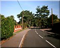
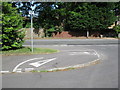
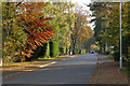
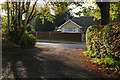
34 photos from this area
Area Information
Key information about the RG40 3NZ including its size, population, and administrative classification.
- Area Type
- Postcode
- Area Size
- 4.1 hectares
- Population
- 1130
- Population Density
- 705 people/km²
House Prices in RG40 3NZ
24
Properties
£784,591
Average Sold Price
£238,000
Lowest Price
£1,200,000
Highest Price
Showing 24 properties
| Address | Type | Beds | Baths | Last Sale Price | Last Sale Date | |
|---|---|---|---|---|---|---|
| 7 Tomlinson Drive, Finchampstead, RG40 3NZ | Detached | 5 | 2 | £1,050,000 | Mar 2025 | |
| 21 Tomlinson Drive, Finchampstead, RG40 3NZ | Detached | 5 | 3 | £1,200,000 | Nov 2024 | |
| 19 Tomlinson Drive, Finchampstead, RG40 3NZ | Detached | 5 | 3 | £1,100,000 | Aug 2022 | |
| 23 Tomlinson Drive, Finchampstead, RG40 3NZ | house | 5 | - | £1,045,000 | Aug 2021 | |
| 12 Tomlinson Drive, Finchampstead, RG40 3NZ | house | 5 | 1 | £1,140,000 | Mar 2021 | |
| 9 Tomlinson Drive, Finchampstead, RG40 3NZ | Detached | 5 | 3 | £860,000 | Jul 2020 | |
| 18 Tomlinson Drive, Finchampstead, RG40 3NZ | house | - | - | £710,000 | Feb 2012 | |
| 25 Tomlinson Drive, Finchampstead, RG40 3NZ | Detached | - | - | £607,500 | Dec 2006 | |
| 5 Tomlinson Drive, Finchampstead, RG40 3NZ | Detached | - | - | £340,000 | Feb 1999 | |
| 22 Tomlinson Drive, Finchampstead, RG40 3NZ | Detached | - | - | £340,000 | May 1998 |
Page 1 of 3
Energy Efficiency in RG40 3NZ
Amenities
Schools
| Rank | School | Type | Entry gender | Ages |
|---|
Explore more schools in this area
Go to Schools tabDemographics
Household Size
Family (3-5 people)
most common
Accommodation Type
Houses
most common
Tenure
92
majority
Ethnic Group
White
most common
Religion
N/A
most common
Household Composition
N/A
most common
Age
47
median
Adults (30-64 years)
most common
Household Deprivation
N/A
with no deprivation
NS-SEC
57
in Lower managerial occupations
Explore more demographic insights in this area
Go to Demographics tabPlanning
Planning Constraints
- Flood RiskPremium
- Ramsar Wetland SitesPremium
- Area of Outstanding Natural BeautyPremium
- Protected Nature ReservePremium
- Protected WoodlandPremium