Area Overview for RG40 2BU
Photos of RG40 2BU
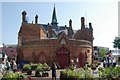

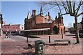
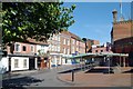
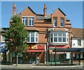
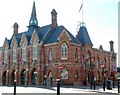
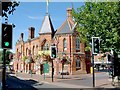
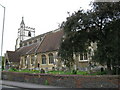


100 photos from this area
Area Information
Key information about the RG40 2BU including its size, population, and administrative classification.
- Area Type
- Postcode
- Area Size
- 6678 m²
- Population
- 1808
- Population Density
- 4538 people/km²
House Prices in RG40 2BU
35
Properties
£360,272
Average Sold Price
£103,000
Lowest Price
£685,000
Highest Price
Showing 35 properties
| Address | Type | Beds | Baths | Last Sale Price | Last Sale Date | |
|---|---|---|---|---|---|---|
| 59 Langborough Road, Wokingham, RG40 2BU | Terraced | 2 | 1 | £285,000 | Dec 2024 | |
| 5 Langborough Road, Wokingham, RG40 2BU | Terraced | 2 | 1 | £435,000 | Aug 2024 | |
| 11A Langborough Road, Wokingham, RG40 2BU | Terraced | 3 | 1 | £555,000 | Aug 2024 | |
| 53 Langborough Road, Wokingham, RG40 2BU | Terraced | 2 | 1 | £390,000 | Aug 2024 | |
| 3A Langborough Road, Wokingham, RG40 2BU | Detached | 4 | 1 | £685,000 | Jun 2024 | |
| 23 Langborough Road, Wokingham, RG40 2BU | Terraced | 2 | 1 | £385,000 | Feb 2023 | |
| 51 Langborough Road, Wokingham, RG40 2BU | Semi-detached | 3 | 2 | £640,000 | Jan 2023 | |
| 63 Langborough Road, Wokingham, RG40 2BU | Terraced | 3 | 1 | £405,000 | Dec 2022 | |
| 27 Langborough Road, Wokingham, RG40 2BU | Terraced | 2 | 1 | £375,000 | Jul 2022 | |
| 45 Langborough Road, Wokingham, RG40 2BU | house | 3 | - | £525,000 | Jun 2021 |
Page 1 of 4
Energy Efficiency in RG40 2BU
Amenities
Schools
| Rank | School | Type | Entry gender | Ages |
|---|
Explore more schools in this area
Go to Schools tabDemographics
Household Size
One person
most common
Accommodation Type
Houses
most common
Tenure
49
majority
Ethnic Group
White
most common
Religion
N/A
most common
Household Composition
N/A
most common
Age
47
median
Adults (30-64 years)
most common
Household Deprivation
N/A
with no deprivation
NS-SEC
51
in Lower managerial occupations
Explore more demographic insights in this area
Go to Demographics tabPlanning
Planning Constraints
- Flood RiskPremium
- Ramsar Wetland SitesPremium
- Area of Outstanding Natural BeautyPremium
- Protected Nature ReservePremium
- Protected WoodlandPremium