Area Overview for RG40 2AD
Photos of RG40 2AD
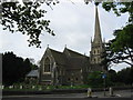
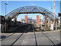
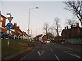
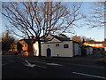
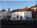
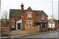
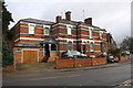
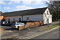
100 photos from this area
Area Information
Key information about the RG40 2AD including its size, population, and administrative classification.
- Area Type
- Postcode
- Area Size
- 5133 m²
- Population
- 2131
- Population Density
- 4124 people/km²
House Prices in RG40 2AD
11
Properties
£226,303
Average Sold Price
£159,000
Lowest Price
£270,000
Highest Price
Showing 11 properties
| Address | Type | Beds | Baths | Last Sale Price | Last Sale Date | |
|---|---|---|---|---|---|---|
| 25A Station Road, Wokingham, RG40 2AD | Maisonette | 2 | 1 | £270,000 | Jun 2015 | |
| 25 Station Road, Wokingham, RG40 2AD | Maisonette | 1 | - | £270,000 | Jun 2015 | |
| 29 Station Road, Wokingham, RG40 2AD | house | - | - | £159,000 | May 2006 | |
| 27 Station Road, Wokingham, RG40 2AD | Semi-detached | - | - | £206,210 | Nov 1998 | |
| Flat 2, The Molly Millar, 59 Station Road, Wokingham, RG40 2AD | Terraced | 4 | - | - | - | |
| Flat 1, The Molly Millar, 59 Station Road, Wokingham, RG40 2AD | Flat | - | - | - | - | |
| 27A Station Road, Wokingham, RG40 2AD | Flat | - | - | - | - | |
| The Station Tap, 59 Station Road, Wokingham, RG40 2AD | Leisure | - | - | - | - | |
| Flat 2, The Hope And Anchor, Station Road, Wokingham, RG40 2AD | Flat | - | - | - | - | |
| Flat 1, The Hope And Anchor, Station Road, Wokingham, RG40 2AD | Flat | - | - | - | - |
Page 1 of 2
Energy Efficiency in RG40 2AD
Amenities
Schools
| Rank | School | Type | Entry gender | Ages |
|---|
Explore more schools in this area
Go to Schools tabDemographics
Household Size
One person
most common
Accommodation Type
Houses
most common
Tenure
56
majority
Ethnic Group
White
most common
Religion
N/A
most common
Household Composition
N/A
most common
Age
47
median
Adults (30-64 years)
most common
Household Deprivation
N/A
with no deprivation
NS-SEC
45
in Lower managerial occupations
Explore more demographic insights in this area
Go to Demographics tabPlanning
Planning Constraints
- Flood RiskPremium
- Ramsar Wetland SitesPremium
- Area of Outstanding Natural BeautyPremium
- Protected Nature ReservePremium
- Protected WoodlandPremium