Area Overview for RG40 1TP
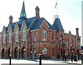
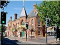
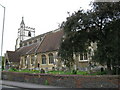
Photos of RG40 1TP

Area Information
Living in RG40 1TP offers a defined residential experience within a specific postcode cluster. This small area covers just 5326 square metres and is home to a population of 1820 residents. You will find that this tight-knit community is characterised by a focus on stability and established housing. The density here is considerable, reflecting a street-level environment where neighbours likely know one another. You are entering a neighbourhood where daily life revolves around local interactions rather than the sprawl of larger districts. The area represents a singular residential unit rather than a broad region, making it a concentrated choice for those seeking a quiet location. With over 1800 people calling this small space home, the sense of place is immediate. You live in an environment where every address is part of a larger, cohesive whole. This layout ensures that services and local life are within immediate practical reach. The distinct nature of the RG40 1TP postcode means you are buying into a specific, manageable footprint. This approach suits those who prefer a settled routine where the boundaries of their daily world are clearly defined.
- Area Type
- Postcode
- Area Size
- 5326 m²
- Population
- 1820
- Population Density
- 4720 people/km²
Homes in RG40 1TP are predominantly houses rather than flats or apartments. This architectural style suits the household types found in the area. The market here functions largely on an owner-occupied basis with a 43 per cent home ownership rate. This percentage highlights a significant proportion of the population resides in their own properties. When you consider this specific postcode, you are entering a market dominated by single-family homes. This housing stock appeals to those who value garden space and independent living arrangements. The presence of houses correlates directly with the adult demographic and family structures present. You will find a selection of properties designed for permanence rather than short-term letting. This稳定房源结构 supports residents seeking to settle down. The low density in terms of accommodation variety reinforces the character of a leafy, house-centric environment. Buyers can expect a traditional residential setting rather than the density typical of flat-heavy zones.
House Prices in RG40 1TP
Showing 8 properties
| Address | Type | Beds | Baths | Last Sale Price | Last Sale Date | |
|---|---|---|---|---|---|---|
| 20 Wiltshire Road, Wokingham, RG40 1TP | Flat | 1 | 1 | £350,000 | Mar 2025 | |
| 22A Wiltshire Road, Wokingham, RG40 1TP | house | - | - | £556,000 | Dec 2021 | |
| 24A Wiltshire Road, Wokingham, RG40 1TP | Bungalow | 2 | 1 | £480,000 | Apr 2021 | |
| 20A Wiltshire Road, Wokingham, RG40 1TP | Maisonette | 1 | - | £225,000 | Sep 2019 | |
| 26 Wiltshire Road, Wokingham, RG40 1TP | Detached | 4 | 2 | £532,500 | Sep 2019 | |
| 24 Wiltshire Road, Wokingham, RG40 1TP | Flat | 1 | - | £385,000 | Nov 2007 | |
| 22 Wiltshire Road, Wokingham, RG40 1TP | Semi-detached | 4 | 1 | - | - | |
| 7 Wiltshire Road, Wokingham, RG40 1TP | Detached | 1 | - | - | - |
Energy Efficiency in RG40 1TP
Residents of RG40 1TP benefit from practical access to major retail and transport hubs. Within practical reach, you will find five retail options including Morrisons Daily Wokingham 40, Waitrose Wokingham, and Cook Wokingham. These supermarkets provide daily necessities without the need for long commutes. You can manage weekly groceries and household shopping with ease. Connectivity extends to rail travel with five rail stations nearby. Winnersh Railway Station, Winnersh Triangle Railway Station, and Wokingham Railway Station are among the key transport links. You have three specific stations to choose from depending on your destination. These links open up wider travel opportunities beyond your local postcode. The presence of these amenities creates a lifestyle where you combine local convenience with wider regional access. Shopping and commuting are integrated into the daily rhythm of life here.
Amenities
Schools
Families living in RG40 1TP have several primary education options nearby. Three of the nearest institutions include Whitelocke Infant and Nursery School, The Palmer Church of England Junior School, and All Saints CofE (Aided) Primary School. You also have access to All Saints Church of England Primary School, which holds a good Ofsted rating. These schools cater specifically to children in the primary education phase. The mix of Church of England and non-denominational primary schools provides choice for parents with different religious preferences. All Saints Church of England Primary School stands out with its verified good rating from the inspectorate. This means you have a specific school with a formal standard of quality right on your doorstep. The other listed schools are standard primary provision. You do not need to look further than these immediate neighbours for primary education. This concentration of schools supports the community needs of the adult population that resides here.
| Rank | School | Type | Entry gender | Ages |
|---|
Explore more schools in this area
Go to Schools tabDemographics
The community in RG40 1TP reflects a mature demographic profile with a median age of 47 years. Most residents fall within the adult age range of 30 to 64 years. You will not find a youthful influx of students or young families as the dominant group. This distribution suggests a neighbourhood favoured by established adults and families. Home ownership stands at 43 per cent of the resident population. This figure indicates that just under half of the households own their property outright. The remaining households live in rental accommodation. Houses form the primary accommodation type across the postcode. The predominant ethnic group is White, marking the area as ethnically homogeneous. These specific figures create a stable social fabric where long-term residents maintain their connection to the location. You are looking at a community defined by its age and ownership structure rather than transient populations.
Household Size
Accommodation Type
Tenure
Ethnic Group
Religion
Household Composition
Age
Household Deprivation
NS-SEC
Explore more demographic insights in this area
Go to Demographics tabPlanning
Planning Constraints
- Flood RiskPremium
- Ramsar Wetland SitesPremium
- Area of Outstanding Natural BeautyPremium
- Protected Nature ReservePremium
- Protected WoodlandPremium