Area Overview for RG4 9RP
Photos of RG4 9RP
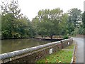
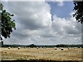

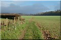
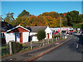

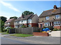
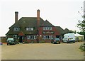

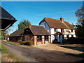

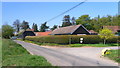
13 photos from this area
Area Information
Key information about the RG4 9RP including its size, population, and administrative classification.
- Area Type
- Postcode
- Area Size
- 1.0 hectares
- Population
- 1611
- Population Density
- 931 people/km²
House Prices in RG4 9RP
14
Properties
£491,306
Average Sold Price
£169,000
Lowest Price
£807,000
Highest Price
Showing 14 properties
| Address | Type | Beds | Baths | Last Sale Price | Last Sale Date | |
|---|---|---|---|---|---|---|
| 78 Peppard Road, Sonning Common, Reading, RG4 9RP | house | - | - | £650,000 | Mar 2025 | |
| Oak House, 88A Peppard Road, Sonning Common, Reading, RG4 9RP | Detached | 4 | 2 | £807,000 | Nov 2020 | |
| 82 Peppard Road, Sonning Common, Reading, RG4 9RP | Bungalow | 3 | 1 | £650,000 | May 2019 | |
| 74 Peppard Road, Sonning Common, Reading, RG4 9RP | Semi-detached | 3 | 2 | £495,000 | Feb 2017 | |
| 84 Peppard Road, Sonning Common, Reading, RG4 9RP | Detached | 3 | 1 | £640,000 | Oct 2015 | |
| 88 Peppard Road, Sonning Common, Reading, RG4 9RP | Detached | 3 | - | £700,000 | Apr 2014 | |
| 72 Peppard Road, Sonning Common, Reading, RG4 9RP | house | - | - | £272,055 | Jun 2011 | |
| 76 Peppard Road, Sonning Common, Reading, RG4 9RP | Semi-detached | - | - | £220,000 | Jan 2006 | |
| 86 Peppard Road, Sonning Common, Reading, RG4 9RP | Detached | - | - | £310,000 | Jul 2001 | |
| 66 Peppard Road, Sonning Common, Reading, RG4 9RP | Detached | - | - | £169,000 | May 1998 |
Page 1 of 2
Energy Efficiency in RG4 9RP
Amenities
Schools
| Rank | School | Type | Entry gender | Ages |
|---|
Explore more schools in this area
Go to Schools tabDemographics
Household Size
Family (3-5 people)
most common
Accommodation Type
Houses
most common
Tenure
65
majority
Ethnic Group
White
most common
Religion
N/A
most common
Household Composition
N/A
most common
Age
47
median
Adults (30-64 years)
most common
Household Deprivation
N/A
with no deprivation
NS-SEC
40
in Lower managerial occupations
Explore more demographic insights in this area
Go to Demographics tabPlanning
Planning Constraints
- Flood RiskPremium
- Ramsar Wetland SitesPremium
- Area of Outstanding Natural BeautyPremium
- Protected Nature ReservePremium
- Protected WoodlandPremium