Area Overview for RG4 8BT
Photos of RG4 8BT
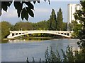
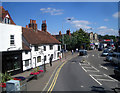
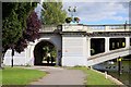
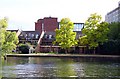
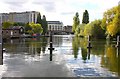
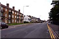
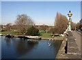
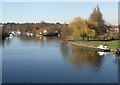
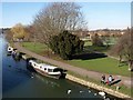
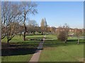
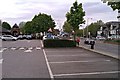

100 photos from this area
Area Information
Key information about the RG4 8BT including its size, population, and administrative classification.
- Area Type
- Postcode
- Area Size
- 6528 m²
- Population
- 1806
- Population Density
- 6379 people/km²
House Prices in RG4 8BT
54
Properties
£262,877
Average Sold Price
£91,500
Lowest Price
£430,000
Highest Price
Showing 54 properties
| Address | Type | Beds | Baths | Last Sale Price | Last Sale Date | |
|---|---|---|---|---|---|---|
| Flat 7, The Waterhouse, 7-9 Gosbrook Road, Caversham, Reading, RG4 8BT | Flat | 1 | 1 | £280,000 | Jan 2024 | |
| 25 Gosbrook Road, Caversham, Reading, RG4 8BT | house | - | - | £360,000 | May 2022 | |
| 41 Gosbrook Road, Caversham, Reading, RG4 8BT | house | - | - | £401,000 | Jan 2022 | |
| 35 Gosbrook Road, Caversham, Reading, RG4 8BT | Terraced | 3 | 2 | £430,000 | Nov 2017 | |
| 21 Gosbrook Road, Caversham, Reading, RG4 8BT | house | 1 | 2 | £270,000 | Oct 2014 | |
| 43 Gosbrook Road, Caversham, Reading, RG4 8BT | Terraced | - | - | £212,500 | Jan 2014 | |
| 29 Gosbrook Road, Caversham, Reading, RG4 8BT | Terraced | - | - | £205,000 | Dec 2007 | |
| 37 Gosbrook Road, Caversham, Reading, RG4 8BT | Flat | 1 | 1 | £334,142 | Aug 2007 | |
| 31 Gosbrook Road, Caversham, Reading, RG4 8BT | Terraced | - | - | £152,500 | Apr 2006 | |
| 33 Gosbrook Road, Caversham, Reading, RG4 8BT | Terraced | - | - | £155,000 | Nov 2000 |
Page 1 of 6
Energy Efficiency in RG4 8BT
Amenities
Schools
| Rank | School | Type | Entry gender | Ages |
|---|
Explore more schools in this area
Go to Schools tabDemographics
Household Size
One person
most common
Accommodation Type
Houses
most common
Tenure
48
majority
Ethnic Group
White
most common
Religion
N/A
most common
Household Composition
N/A
most common
Age
47
median
Adults (30-64 years)
most common
Household Deprivation
N/A
with no deprivation
NS-SEC
54
in Lower managerial occupations
Explore more demographic insights in this area
Go to Demographics tabPlanning
Planning Constraints
- Flood RiskPremium
- Ramsar Wetland SitesPremium
- Area of Outstanding Natural BeautyPremium
- Protected Nature ReservePremium
- Protected WoodlandPremium