Area Overview for RG4 7HS
Photos of RG4 7HS
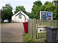
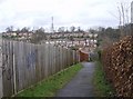
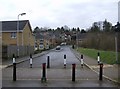
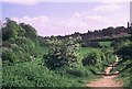
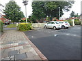
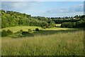
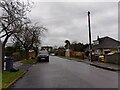
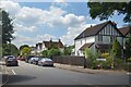
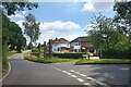
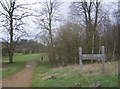
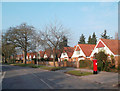
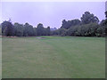
24 photos from this area
Area Information
Key information about the RG4 7HS including its size, population, and administrative classification.
- Area Type
- Postcode
- Area Size
- 2.7 hectares
- Population
- 1576
- Population Density
- 3474 people/km²
House Prices in RG4 7HS
52
Properties
£415,307
Average Sold Price
£96,000
Lowest Price
£730,000
Highest Price
Showing 52 properties
| Address | Type | Beds | Baths | Last Sale Price | Last Sale Date | |
|---|---|---|---|---|---|---|
| 21 Geoffreyson Road, Caversham, Reading, RG4 7HS | Semi-detached | 4 | 2 | £685,000 | Dec 2023 | |
| 12 Geoffreyson Road, Caversham, Reading, RG4 7HS | house | - | - | £650,000 | Dec 2022 | |
| 38 Geoffreyson Road, Caversham, Reading, RG4 7HS | Semi-detached | 4 | 2 | £665,000 | Oct 2022 | |
| 22 Geoffreyson Road, Caversham, Reading, RG4 7HS | Semi-detached | 4 | 3 | £720,000 | Apr 2022 | |
| 11 Geoffreyson Road, Caversham, Reading, RG4 7HS | house | - | - | £575,000 | Sep 2021 | |
| 16 Geoffreyson Road, Caversham, Reading, RG4 7HS | house | - | - | £730,000 | Feb 2021 | |
| 34 Geoffreyson Road, Caversham, Reading, RG4 7HS | house | - | - | £470,000 | Feb 2021 | |
| 19 Geoffreyson Road, Caversham, Reading, RG4 7HS | house | - | - | £513,000 | Jul 2019 | |
| 20 Geoffreyson Road, Caversham, Reading, RG4 7HS | Semi-detached | 3 | 2 | £675,000 | Jun 2019 | |
| 26 Geoffreyson Road, Caversham, Reading, RG4 7HS | Semi-detached | 3 | 1 | £515,000 | Jan 2019 |
Page 1 of 6
Energy Efficiency in RG4 7HS
Amenities
Schools
| Rank | School | Type | Entry gender | Ages |
|---|
Explore more schools in this area
Go to Schools tabDemographics
Household Size
Family (3-5 people)
most common
Accommodation Type
Houses
most common
Tenure
93
majority
Ethnic Group
White
most common
Religion
N/A
most common
Household Composition
N/A
most common
Age
47
median
Adults (30-64 years)
most common
Household Deprivation
N/A
with no deprivation
NS-SEC
55
in Lower managerial occupations
Explore more demographic insights in this area
Go to Demographics tabPlanning
Planning Constraints
- Flood RiskPremium
- Ramsar Wetland SitesPremium
- Area of Outstanding Natural BeautyPremium
- Protected Nature ReservePremium
- Protected WoodlandPremium