Area Overview for RG4 6XB
Photos of RG4 6XB
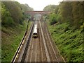
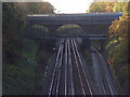
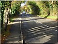
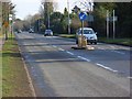
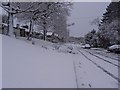
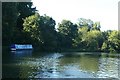
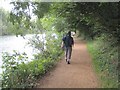
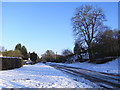
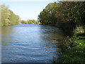
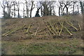
59 photos from this area
Area Information
Key information about the RG4 6XB including its size, population, and administrative classification.
- Area Type
- Postcode
- Area Size
- 6.7 hectares
- Population
- 1615
- Population Density
- 340 people/km²
House Prices in RG4 6XB
32
Properties
£640,889
Average Sold Price
£225,000
Lowest Price
£1,350,000
Highest Price
Showing 32 properties
| Address | Type | Beds | Baths | Last Sale Price | Last Sale Date | |
|---|---|---|---|---|---|---|
| 12 Sonning Meadows, Sonning, RG4 6XB | Detached | 5 | 2 | £950,000 | May 2024 | |
| 26 Sonning Meadows, Sonning, RG4 6XB | Detached | 5 | 3 | £1,350,000 | Sep 2022 | |
| 19 Sonning Meadows, Sonning, RG4 6XB | Detached | 5 | 2 | £940,000 | Mar 2021 | |
| 16 Sonning Meadows, Sonning, RG4 6XB | Detached | 5 | 2 | £910,000 | Jan 2018 | |
| 4 Sonning Meadows, Sonning, RG4 6XB | house | - | - | £630,000 | Jun 2012 | |
| 20 Sonning Meadows, Sonning, RG4 6XB | house | 5 | - | £700,000 | Nov 2011 | |
| 2 Sonning Meadows, Sonning, RG4 6XB | house | - | - | £590,000 | Jan 2011 | |
| 25 Sonning Meadows, Sonning, RG4 6XB | house | - | - | £653,000 | Oct 2010 | |
| 22 Sonning Meadows, Sonning, RG4 6XB | Detached | - | - | £575,000 | Jan 2009 | |
| 23 Sonning Meadows, Sonning, RG4 6XB | Detached | - | - | £625,000 | Jan 2007 |
Page 1 of 4
Energy Efficiency in RG4 6XB
Amenities
Schools
| Rank | School | Type | Entry gender | Ages |
|---|
Explore more schools in this area
Go to Schools tabDemographics
Household Size
Family (3-5 people)
most common
Accommodation Type
Houses
most common
Tenure
74
majority
Ethnic Group
White
most common
Religion
N/A
most common
Household Composition
N/A
most common
Age
47
median
Adults (30-64 years)
most common
Household Deprivation
N/A
with no deprivation
NS-SEC
53
in Lower managerial occupations
Explore more demographic insights in this area
Go to Demographics tabPlanning
Planning Constraints
- Flood RiskPremium
- Ramsar Wetland SitesPremium
- Area of Outstanding Natural BeautyPremium
- Protected Nature ReservePremium
- Protected WoodlandPremium