Area Overview for RG4 6SU
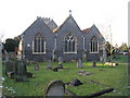
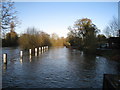
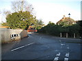
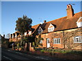
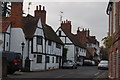
Photos of RG4 6SU


Area Information
RG4 6SU is a small residential cluster covering 7.9 hectares in Berkshire, England. This tightly defined postcode serves a population of 1,615 residents, resulting in a density of 340 people per square kilometre. Living in this specific area means sharing immediate proximity with neighbours while retaining a sense of localized community space. The physical footprint is compact, designed primarily for housing rather than industrial or large-scale commercial sprawl. Prospective homebuyers looking at this slice of Reading's urban fabric find themselves in a zone defined by its residential purpose and manageable scale. The area forms part of the broader RG4 postcode district, offering a snapshot of suburban living close to Reading town centre without extending into the wider countryside. Daily life here revolves around practicalities, with residents navigating a modest spread of housing that caters to established home ownership rather than transient renting. The specific geography of this hectare-defined zone shapes how commutes occur, how local streets are used, and how neighbours interact within such a concentrated setting. For those researching homes in this postcode, the compact nature of the site suggests limited variation in property character compared to larger, more diverse estates. Instead, the focus rests on the quality of individual dwellings and the quiet presence of a stable, predominantly residential neighbourhood.
- Area Type
- Postcode
- Area Size
- 7.9 hectares
- Population
- 1615
- Population Density
- 340 people/km²
The property market in RG4 6SU is defined by a strong emphasis on ownership rather than renting. With home ownership standing at 74%, this local cluster operates largely as an owner-occupied community. This high percentage indicates that houses in the area are typically bought with mortgages or through inheritance, rather than being held for short-term rental yielding. The accommodation type comprises exclusively houses, excluding flats, bungalows, or other non-house structures. This uniformity suggests a development history focused on single-family living, catering to buyers who require private gardens and independent living spaces. For anyone looking at homes in this specific postcode, the market offers stability, as properties tend to remain in the family for decades. The concentration of ownership reduces the turnover rate seen in areas with high rental shares, meaning neighbours are more likely to have known each other long-term. The absence of rental properties in the data implies that the local housing supply suits owners looking for lasting investment rather than landlords seeking quick returns. Buyers should expect a market where price dynamics are influenced by long-term maintenance standards and neighbourhood reputation rather than short-term rental yield potential. The 74% ownership rate fosters an environment where community improvement often depends on resident initiative rather than landlord mandates.
House Prices in RG4 6SU
Showing 17 properties
| Address | Type | Beds | Baths | Last Sale Price | Last Sale Date | |
|---|---|---|---|---|---|---|
| Bernard Inge Building, Reading Blue Coat School, Sonning Lane, Sonning, RG4 6SU | commercial | - | - | - | - | |
| Gaines Cooper Building, Reading Blue Coat School, Sonning Lane, Sonning, RG4 6SU | commercial | - | - | - | - | |
| Roddy Messer Building, Reading Blue Coat School, Sonning Lane, Sonning, RG4 6SU | commercial | - | - | - | - | |
| Alan Sanders Science Centre, Reading Blue Coat School, Sonning Lane, Sonning, RG4 6SU | commercial | - | - | - | - | |
| Cricket Pavilion, Reading Blue Coat School, Sonning Lane, Sonning, RG4 6SU | commercial | - | - | - | - | |
| Sports Hall, Reading Blue Coat School, Sonning Lane, Sonning, RG4 6SU | commercial | - | - | - | - | |
| Dunster Building, Reading Blue Coat School, Sonning Lane, Sonning, RG4 6SU | commercial | - | - | - | - | |
| Boat House, Reading Blue Coat School, Sonning Lane, Sonning, RG4 6SU | commercial | - | - | - | - | |
| Lesser Building, Reading Blue Coat School, Sonning Lane, Sonning, RG4 6SU | commercial | - | - | - | - | |
| Stable Block, Reading Blue Coat School, Sonning Lane, Sonning, RG4 6SU | commercial | - | - | - | - |
Energy Efficiency in RG4 6SU
Living in RG4 6SU places you within practical reach of specific retail outlets and transport hubs. The area has five notable retail venues nearby, including the petrol station retail link at the M&S Sonning Cutting Reading BP, the fashion outlet at the M&S Woodley Reading SF, and the budget supermarket Aldi North. These shops provide essential groceries, clothing, and fuel within a short drive or walk if public transport links are accessed. For rail travel, residents have access to five railway stations, prominently featuring Earley Railway Station, Twyford Railway Station, and Reading Railway Station. These stations offer direct connections into the wider train network, facilitating commuting into London or other regional centres. The presence of M&S branches in both Sonning Cutting and Woodley indicates that branded shopping is readily accessible. The Aldi location ensures value-focused grocery shopping is available without needing to travel deep into Reading town centre. This blend of motorway service station retail and dedicated supermarket chains supports the needs of the 1,615 local residents. Daily life here balances the convenience of nearby specific amenities with the need to plan trips to Reading for larger department stores or enhanced leisure facilities not listed in this immediate cluster.
Amenities
Schools
Families considering living in RG4 6SU have access to several educational institutions nearby. The local primary option is Sonning Church of England Primary School, which serves the younger cohort of children. Parents seeking independent education have Reading Blue Coat School available as a nearby choice for their children's secondary or preparatory years. The presence of both a Church of England primary school and an independent institution offers a variety of philosophical and curricular approaches to local families. This mix caters to those who prefer religious education alongside those who seek the full board education provided by independent schools. Living in this area means you can access schooling without travelling across Reading town for day services. Although specific Ofsted ratings are not listed in the current records, the availability of Sonning Church of England Primary School and Reading Blue Coat School provides a solid educational nearby. Parents must visit these institutions directly to review current inspection reports and suitability for their child's specific needs. The proximity of these schools supports the family demographic identified in the local census data.
| Rank | School | Type | Entry gender | Ages |
|---|
Explore more schools in this area
Go to Schools tabDemographics
The community within RG4 6SU reflects a mature demographic profile, with a median age of 47 years. The most common age range for residents falls between 30 and 64 years, indicating a neighbourhood dominated by adults rather than young families or retirees. This age distribution suggests an area where long-term stability prevails, as younger workforces and elderly populations make up a smaller proportion of the total 1,615 inhabitants. Home ownership stands at a high 74%, which signals that the vast majority of properties in this cluster are family-owned and rarely change hands due to investment speculation. The local housing stock consists almost entirely of houses, fitting the profile of a suburban area rather than a high-rise or flats-dominant district. Census data shows that the predominant ethnic group in the area is White, mirroring the traditional demographic makeup of many established suburbs in Reading. While specific deprivation statistics are not detailed in the current records, the high level of home ownership often correlates with financial stability among the local population. Residents in this age bracket typically enjoy significant disposable income and established careers, contributing to a neighbourhood character that values permanence over rapid turnover. The demographic weight on adults between 30 and 64 years old means that local services and amenities cater primarily to households with established needs rather than transient young professionals or students.
Household Size
Accommodation Type
Tenure
Ethnic Group
Religion
Household Composition
Age
Household Deprivation
NS-SEC
Explore more demographic insights in this area
Go to Demographics tabPlanning
Planning Constraints
- Flood RiskPremium
- Ramsar Wetland SitesPremium
- Area of Outstanding Natural BeautyPremium
- Protected Nature ReservePremium
- Protected WoodlandPremium