Area Overview for RG4 6DW
Photos of RG4 6DW
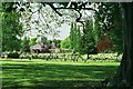
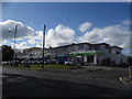
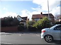
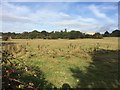
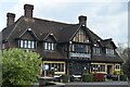
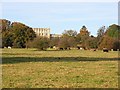

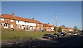
63 photos from this area
Area Information
Key information about the RG4 6DW including its size, population, and administrative classification.
- Area Type
- Postcode
- Area Size
- 7653 m²
- Population
- 1655
- Population Density
- 7163 people/km²
House Prices in RG4 6DW
18
Properties
£280,950
Average Sold Price
£66,950
Lowest Price
£500,000
Highest Price
Showing 18 properties
| Address | Type | Beds | Baths | Last Sale Price | Last Sale Date | |
|---|---|---|---|---|---|---|
| 147 Henley Road, Caversham, Reading, RG4 6DW | house | - | - | £395,000 | Jul 2021 | |
| 135 Henley Road, Caversham, Reading, RG4 6DW | house | 2 | - | £340,000 | Jan 2021 | |
| 131 Henley Road, Caversham, Reading, RG4 6DW | Terraced | 2 | 1 | £330,000 | Jan 2020 | |
| 117 Henley Road, Caversham, Reading, RG4 6DW | Terraced | 3 | 1 | £290,000 | Jun 2019 | |
| 133 Henley Road, Caversham, Reading, RG4 6DW | Terraced | 3 | 1 | £315,000 | Apr 2019 | |
| 129 Henley Road, Caversham, Reading, RG4 6DW | Terraced | 3 | 1 | £377,500 | Oct 2017 | |
| 145 Henley Road, Caversham, Reading, RG4 6DW | house | 4 | 2 | £500,000 | Jan 2017 | |
| 121 Henley Road, Caversham, Reading, RG4 6DW | Terraced | 3 | 1 | £175,000 | Jul 2009 | |
| 127 Henley Road, Caversham, Reading, RG4 6DW | Terraced | - | - | £196,000 | May 2006 | |
| 125 Henley Road, Caversham, Reading, RG4 6DW | Terraced | - | - | £105,000 | Jul 1999 |
Page 1 of 2
Energy Efficiency in RG4 6DW
Amenities
Schools
| Rank | School | Type | Entry gender | Ages |
|---|
Explore more schools in this area
Go to Schools tabDemographics
Household Size
Two person
most common
Accommodation Type
Houses
most common
Tenure
62
majority
Ethnic Group
White
most common
Religion
N/A
most common
Household Composition
N/A
most common
Age
47
median
Adults (30-64 years)
most common
Household Deprivation
N/A
with no deprivation
NS-SEC
43
in Lower managerial occupations
Explore more demographic insights in this area
Go to Demographics tabPlanning
Planning Constraints
- Flood RiskPremium
- Ramsar Wetland SitesPremium
- Area of Outstanding Natural BeautyPremium
- Protected Nature ReservePremium
- Protected WoodlandPremium