Area Overview for RG4 5BD
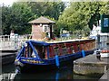
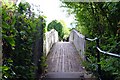
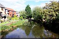
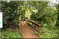
Photos of RG4 5BD


Area Information
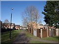
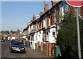
Living in RG4 5BD means residing within a specific residential cluster that forms part of the Reading postcodes. You will be joining a community of 1,593 people in this particular English location. The post area functions as a small, concentrated neighbourhood rather than a sprawling district. Daily life here is defined by proximity, with residents situated close to broader amenities yet maintaining a distinct local identity. This postcode covers a limited area where street layouts are typical of established residential zones. You can expect a quieter environment compared to the busiest hubs of the wider Reading region. The area serves as a contained residential pocket alongside larger neighbouring zones. Your daily commute and leisure activities will likely radiate outwards from this central point. The physical layout supports a standard suburban lifestyle where homes sit in clusters. You are placing your footprints in a defined slice of the Berkshire landscape. This small geographical unit offers a slice of living that balances local intimacy with regional access.
- Area Type
- Postcode
- Area Size
- Not available
- Population
- 1593
- Population Density
- 6287 people/km²
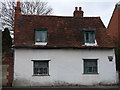
The property market in RG4 5BD is characterised by a dominance of houses. With home ownership reaching 65 per cent of residents, this area functions more as an owner-occupied zone than a high-rental market. You will find that the vast majority of accommodation types are detached or semi-detached houses rather than flats. This structure supports long-term stability and reduces the volatility often seen in student or transient rental hotspots. Buyers looking at homes in RG4 5BD should anticipate a traditional suburban stock. The high ownership rate suggests that vacant properties change hands through sales rather than panicked evictions. This dynamic creates a predictable environment for families seeking to buy a property and stay. The specific postcode nature means inventory moves more like a boutique market. You are not competing in a massive pooled marketplace but looking at a defined set of local homes. The 65 per cent ownership statistic is a key indicator for lenders and buyers assessing stability. Houses remain the primary architectural form here. This skew influences planning and maintenance within the cluster. Your investment here is likely one of long duration.
House Prices in RG4 5BD
No properties found in this postcode.
Energy Efficiency in RG4 5BD
Your lifestyle in RG4 5BD is supported by practical amenities within reach. Retail options include Co-op Caversham, which appears as a notable facility, and Waitrose Caversham for premium grocery needs. There are five retail points of interest in the immediate vicinity. Rail transport is equally accessible with five relevant stations nearby. You can easily reach Reading Railway Station, Reading West Railway Station, and Earley Railway Station for motorway access and wider travel. These five stations are positioned to serve your daily commutes efficiently. Supermarkets provide your weekly shopping without a city centre trek. The concentration of shopping and transport hubs reduces the need for a private car for daily tasks. You can collect essentials from Co-op or Waitrose and head straight to the train. The layout ensures that work and leisure are both logistically simple. Five retail outlets and five rail stations define your immediate convenience radius. This access pattern supports a balanced routine of home and work.
Amenities
Schools
Families living in RG4 5BD have access to specific educational institutions nearby. The most prominent option is St Anne's Catholic Primary School, which holds a good Ofsted rating. This primary school serves as a key local resource for younger children in your immediate vicinity. While there are no secondary schools listed directly within the immediate data for this postcode, you must look beyond the immediate cluster for post-16 education. The presence of a good-rated primary school suggests a solid foundation for early education. The single entry on the list highlights a focused catchment area for early schooling needs. You will need to consult the wider Reading education map for comprehensive solutions covering secondary years. The mix is currently limited to just one primary provider in your immediate list. This concentration can be a benefit for parental networking but may require zonal planning for older children. St Anne's offers a proven track record of educational standards. When planning your move for homes in RG4 5BD, factor in the distance to other types of schools. The good rating provides reassurance for junior years.
| Rank | School | Type | Entry gender | Ages |
|---|
Explore more schools in this area
Go to Schools tabDemographics
The community in RG4 5BD reflects a relatively mature population with a median age of 47 years. Most residents fall into the adult category spanning 30 to 64 years old. This age profile suggests a neighbourhood predominantly occupied by families, established professionals, and retired couples. Home ownership stands at 65 per cent, indicating a strong sense of established residence. The local stock consists primarily of houses rather than flats or purpose-built apartments. You are entering a mix of tenures where the majority of occupants hold their own properties. Ethnically, the demographic is predominantly White, reflecting a traditional composition common in many established suburbs. This level of homogeneity often correlates with lower transient rates and tighter community bonds. The absence of high-rise or multi-generational blocks points toward a tailored living experience. The median age figure serves as a clear marker for family demographics. Adults under 30 represent a smaller fraction of this specific cluster. The 68 per cent home ownership rate further cements the area as a place for settled living. You can expect neighbours who have likely lived in these houses for many years.
Household Size
Accommodation Type
Tenure
Ethnic Group
Religion
Household Composition
Age
Household Deprivation
NS-SEC
Explore more demographic insights in this area
Go to Demographics tabPlanning
Planning Constraints
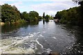
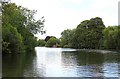
- Flood RiskPremium
- Ramsar Wetland SitesPremium
- Area of Outstanding Natural BeautyPremium
- Protected Nature ReservePremium
- Protected WoodlandPremium