Area Overview for RG4 0HZ
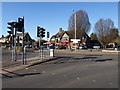
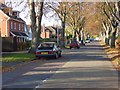
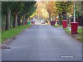
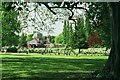
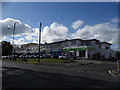
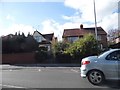
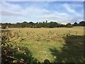
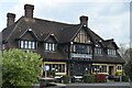
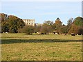
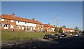
Photos of RG4 0HZ

Area Information
RG4 0HZ represents a small, tightly-knit residential cluster situated in England. With a population of 1,669, this postcode area offers an intimate living environment compared to broader suburban zones. You will find that daily life here is defined by proximity and stability. The community is established, drawing its identity from long-term residents rather than transient housing spots. This specific cluster exists within the RG4 region, providing a distinct micro-community for those seeking a quieter existence away from high-density city centres. The area attracts individuals who value a settled lifestyle over rapid urban expansion. Living in RG4 0HZ means engaging with a neighbourhood where every street corner tells a story of consistent residency. The layout supports local interaction while maintaining privacy. You can expect a sense of routine and familiarity that comes from a defined population limit. This postcode is not a sprawling development but a concentrated group of dwellings designed for residents who know their neighbours. The character of the area is shaped by its size, ensuring that isolation is rare. Homes in RG4 0HZ serve as a anchor point for families and professionals who value a compact living footprint.
- Area Type
- Postcode
- Area Size
- Not available
- Population
- 1669
- Population Density
- 5118 people/km²
The housing market in RG4 0HZ is overwhelmingly dominated by owner-occupied households. With 92% of residents owning their homes, this postcode functions as a classic owner-led estate rather than a student rental hub or high-turnover lettings zone. The accommodation type is strictly houses, meaning the streetscape is filled with detached, semi-detached, or terraced families homes rather than apartment blocks. This structural uniformity creates a neighbourhood where property values tend to mirror traditional suburban trends. You will find that buying homes in RG4 0HZ often involves purchasing a long-term legacy asset rather than a speculative investment property. The low rate of tenure implies that few residents move within a single year. This stability benefits buyers looking for a quiet, non-low-maintenance property environment where the original occupants often remain. The market does not show signs of being a tourist hotspot or a seasonal rental destination. Instead, it serves a local clientele who have chosen this specific cluster for its privacy and house-based lifestyle. If you are considering this area, you compete more with other resident sellers than with landlords. The housing stock reflects a deliberate choice for ownership and space over density or rental flexibility.
House Prices in RG4 0HZ
No properties found in this postcode.
Energy Efficiency in RG4 0HZ
Daily life for residents of RG4 0HZ is supported by a convenient array of amenities within practical reach. Shopping opportunities centre around retail hubs such as Co-op Caversham and Tesco Emmer. These venues provide essential groceries and general shopping needs without requiring long drives. For your travel requirements, rail networks connect you to Reading Railway Station, Reading West Railway Station, and Earley Railway Station. Access to these stations facilitates easy commutes to wider regions beyond the immediate neighbourhood. The layout of the area ensures that daily errands do not consume excessive time. You can run household chores, pick up weekly provisions, and catch a train all within a short radius of your home. Living in RG4 0HZ balances the quiet of a residential cluster with the convenience of town facilities. The presence of multiple Co-op branches and a Tesco supermarket means fresh food is always accessible. While the area focuses on needs rather than luxury entertainment, the practicality of these amenities enhances overall quality of life. You do not need to travel far to find what you require for a comfortable existence.
Amenities
Schools
| Rank | School | Type | Entry gender | Ages |
|---|
Explore more schools in this area
Go to Schools tabDemographics
The community of RG4 0HZ reflects a mature and established demographic profile. The median age stands at 47 years, indicating that the area is primarily inhabited by adults between 30 and 64 years old. This age range dominates the population, suggesting that the homes in RG4 0HZ cater to those who have already settled down or are mid-career. You will find that children under the age of 30 are less common than middle-aged professionals or empty nesters. Consistently, the predominant ethnic group is White, which contributes to a culturally homogeneous environment for those value familiarity. Home ownership is extremely high, with 92% of residents owning their property outright or with a mortgage. This figure signifies that the majority of households have achieved financial stability within the local market. Almost no one rents long-term in this specific cluster. Accommodation types are exclusively houses, meaning you will not find flats or terraced apartments in this particular postcode. The diversity within the area is low, reflecting a traditional suburban make-up where Long-term residents have shaped the social fabric over decades. This demographic stability means the community is unlikely to change rapidly. You can expect a neighbourly atmosphere where long-standing friendships define social life.
Household Size
Accommodation Type
Tenure
Ethnic Group
Religion
Household Composition
Age
Household Deprivation
NS-SEC
Explore more demographic insights in this area
Go to Demographics tabPlanning
Planning Constraints
- Flood RiskPremium
- Ramsar Wetland SitesPremium
- Area of Outstanding Natural BeautyPremium
- Protected Nature ReservePremium
- Protected WoodlandPremium