Area Overview for RG31 6PA
Photos of RG31 6PA
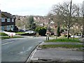
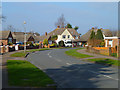

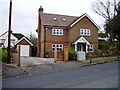


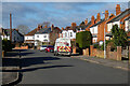
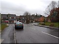
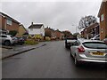
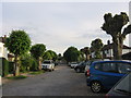
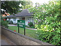
55 photos from this area
Area Information
Key information about the RG31 6PA including its size, population, and administrative classification.
- Area Type
- Postcode
- Area Size
- 2.3 hectares
- Population
- 1495
- Population Density
- 5389 people/km²
House Prices in RG31 6PA
50
Properties
£248,172
Average Sold Price
£91,000
Lowest Price
£490,000
Highest Price
Showing 50 properties
| Address | Type | Beds | Baths | Last Sale Price | Last Sale Date | |
|---|---|---|---|---|---|---|
| 41 Dell Road, Tilehurst, Reading, RG31 6PA | Semi-detached | 2 | 1 | £415,000 | Feb 2025 | |
| 40 Dell Road, Tilehurst, Reading, RG31 6PA | Semi-detached | 3 | 2 | £460,000 | Mar 2024 | |
| 32 Dell Road, Tilehurst, Reading, RG31 6PA | Semi-detached | 3 | 1 | £335,000 | Sep 2023 | |
| 10 Dell Road, Tilehurst, Reading, RG31 6PA | Bungalow | 2 | 1 | £325,000 | Jul 2023 | |
| 50 Dell Road, Tilehurst, Reading, RG31 6PA | Semi-detached | 3 | 3 | £490,000 | Apr 2023 | |
| 29 Dell Road, Tilehurst, Reading, RG31 6PA | Bungalow | 4 | 2 | £450,000 | May 2022 | |
| 11 Dell Road, Tilehurst, Reading, RG31 6PA | Bungalow | 2 | 1 | £369,950 | Sep 2021 | |
| 21 Dell Road, Tilehurst, Reading, RG31 6PA | Bungalow | 2 | 1 | £285,000 | Jul 2019 | |
| 49 Dell Road, Tilehurst, Reading, RG31 6PA | Semi-detached | 3 | 1 | £345,000 | Jan 2018 | |
| 45 Dell Road, Tilehurst, Reading, RG31 6PA | house | 2 | - | £285,000 | Nov 2016 |
Page 1 of 5
Energy Efficiency in RG31 6PA
Amenities
Schools
| Rank | School | Type | Entry gender | Ages |
|---|
Explore more schools in this area
Go to Schools tabDemographics
Household Size
Family (3-5 people)
most common
Accommodation Type
Houses
most common
Tenure
93
majority
Ethnic Group
White
most common
Religion
N/A
most common
Household Composition
N/A
most common
Age
47
median
Adults (30-64 years)
most common
Household Deprivation
N/A
with no deprivation
NS-SEC
36
in Lower managerial occupations
Explore more demographic insights in this area
Go to Demographics tabPlanning
Planning Constraints
- Flood RiskPremium
- Ramsar Wetland SitesPremium
- Area of Outstanding Natural BeautyPremium
- Protected Nature ReservePremium
- Protected WoodlandPremium