Area Overview for RG31 6LE
Photos of RG31 6LE
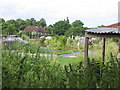
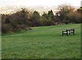
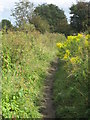
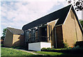
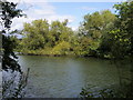

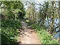


85 photos from this area
Area Information
Key information about the RG31 6LE including its size, population, and administrative classification.
- Area Type
- Postcode
- Area Size
- 2.0 hectares
- Population
- 1671
- Population Density
- 2486 people/km²
House Prices in RG31 6LE
20
Properties
£397,650
Average Sold Price
£225,000
Lowest Price
£641,000
Highest Price
Showing 20 properties
| Address | Type | Beds | Baths | Last Sale Price | Last Sale Date | |
|---|---|---|---|---|---|---|
| 14 Larissa Close, Tilehurst, Reading, RG31 6LE | Terraced | 3 | 4 | £452,500 | Oct 2025 | |
| 3 Larissa Close, Tilehurst, Reading, RG31 6LE | Detached | 4 | 2 | £471,000 | May 2024 | |
| 4 Larissa Close, Tilehurst, Reading, RG31 6LE | Detached | 4 | 3 | £641,000 | Sep 2021 | |
| 10 Larissa Close, Tilehurst, Reading, RG31 6LE | Detached | 4 | 2 | £607,500 | May 2021 | |
| 12 Larissa Close, Tilehurst, Reading, RG31 6LE | Terraced | 3 | 3 | £370,000 | Nov 2020 | |
| 18 Larissa Close, Tilehurst, Reading, RG31 6LE | Terraced | 3 | 3 | £380,000 | Jun 2019 | |
| 19 Larissa Close, Tilehurst, Reading, RG31 6LE | Terraced | 3 | 2 | £389,950 | Jun 2016 | |
| 20 Larissa Close, Tilehurst, Reading, RG31 6LE | Detached | 3 | 2 | £405,950 | Jun 2016 | |
| 21 Larissa Close, Tilehurst, Reading, RG31 6LE | house | - | - | £409,950 | Jun 2016 | |
| 23 Larissa Close, Tilehurst, Reading, RG31 6LE | house | - | - | £409,950 | Jun 2016 |
Page 1 of 2
Energy Efficiency in RG31 6LE
Amenities
Schools
| Rank | School | Type | Entry gender | Ages |
|---|
Explore more schools in this area
Go to Schools tabDemographics
Household Size
Two person
most common
Accommodation Type
Houses
most common
Tenure
85
majority
Ethnic Group
White
most common
Religion
N/A
most common
Household Composition
N/A
most common
Age
47
median
Adults (30-64 years)
most common
Household Deprivation
N/A
with no deprivation
NS-SEC
48
in Lower managerial occupations
Explore more demographic insights in this area
Go to Demographics tabPlanning
Planning Constraints
- Flood RiskPremium
- Ramsar Wetland SitesPremium
- Area of Outstanding Natural BeautyPremium
- Protected Nature ReservePremium
- Protected WoodlandPremium