Area Overview for RG31 6HB
Photos of RG31 6HB
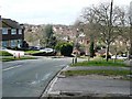
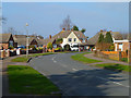

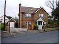

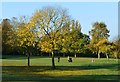

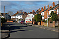
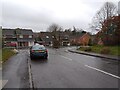
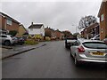
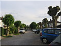
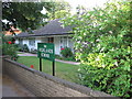
55 photos from this area
Area Information
Key information about the RG31 6HB including its size, population, and administrative classification.
- Area Type
- Postcode
- Area Size
- 8099 m²
- Population
- 1682
- Population Density
- 4979 people/km²
House Prices in RG31 6HB
24
Properties
£231,661
Average Sold Price
£59,950
Lowest Price
£442,000
Highest Price
Showing 24 properties
| Address | Type | Beds | Baths | Last Sale Price | Last Sale Date | |
|---|---|---|---|---|---|---|
| 71 Armour Road, Tilehurst, Reading, RG31 6HB | Terraced | 3 | 1 | £380,000 | Sep 2025 | |
| 105 Armour Road, Tilehurst, Reading, RG31 6HB | Terraced | 2 | 1 | £310,250 | Apr 2024 | |
| 89 Armour Road, Tilehurst, Reading, RG31 6HB | house | - | - | £263,000 | Dec 2023 | |
| 61 Armour Road, Tilehurst, Reading, RG31 6HB | Terraced | 3 | 3 | £442,000 | Jul 2023 | |
| 67 Armour Road, Tilehurst, Reading, RG31 6HB | Terraced | 2 | 1 | £280,000 | Jun 2021 | |
| 83 Armour Road, Tilehurst, Reading, RG31 6HB | house | - | - | £300,000 | May 2021 | |
| 87 Armour Road, Tilehurst, Reading, RG31 6HB | house | - | - | £320,000 | Mar 2021 | |
| 69 Armour Road, Tilehurst, Reading, RG31 6HB | Terraced | 2 | 1 | £265,000 | Oct 2018 | |
| 91 Armour Road, Tilehurst, Reading, RG31 6HB | Terraced | 2 | - | £277,500 | Feb 2016 | |
| 103 Armour Road, Tilehurst, Reading, RG31 6HB | house | - | - | £253,700 | Dec 2015 |
Page 1 of 3
Energy Efficiency in RG31 6HB
Amenities
Schools
| Rank | School | Type | Entry gender | Ages |
|---|
Explore more schools in this area
Go to Schools tabDemographics
Household Size
Family (3-5 people)
most common
Accommodation Type
Houses
most common
Tenure
83
majority
Ethnic Group
White
most common
Religion
N/A
most common
Household Composition
N/A
most common
Age
47
median
Adults (30-64 years)
most common
Household Deprivation
N/A
with no deprivation
NS-SEC
41
in Lower managerial occupations
Explore more demographic insights in this area
Go to Demographics tabPlanning
Planning Constraints
- Flood RiskPremium
- Ramsar Wetland SitesPremium
- Area of Outstanding Natural BeautyPremium
- Protected Nature ReservePremium
- Protected WoodlandPremium