Area Overview for RG31 5PP
Photos of RG31 5PP
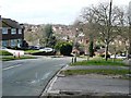
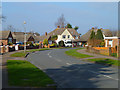

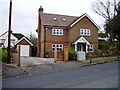


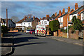
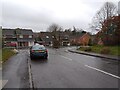
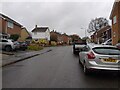
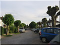
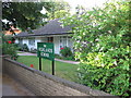
55 photos from this area
Area Information
Key information about the RG31 5PP including its size, population, and administrative classification.
- Area Type
- Postcode
- Area Size
- 7569 m²
- Population
- 1682
- Population Density
- 4979 people/km²
House Prices in RG31 5PP
12
Properties
£421,071
Average Sold Price
£295,000
Lowest Price
£610,000
Highest Price
Showing 12 properties
| Address | Type | Beds | Baths | Last Sale Price | Last Sale Date | |
|---|---|---|---|---|---|---|
| 96 Westwood Road, Tilehurst, Reading, RG31 5PP | house | - | - | £610,000 | Feb 2022 | |
| 94 Westwood Road, Tilehurst, Reading, RG31 5PP | Detached | - | - | £485,000 | Mar 2013 | |
| 70 Westwood Road, Tilehurst, Reading, RG31 5PP | Detached | 5 | - | £413,000 | Jan 2013 | |
| 98 Westwood Road, Tilehurst, Reading, RG31 5PP | house | - | - | £425,000 | Feb 2011 | |
| 102 Westwood Road, Tilehurst, Reading, RG31 5PP | Semi-detached | - | - | £407,500 | Dec 2006 | |
| 88 Westwood Road, Tilehurst, Reading, RG31 5PP | Detached | 4 | 2 | £295,000 | Jun 2003 | |
| 68 Westwood Road, Tilehurst, Reading, RG31 5PP | Detached | - | - | £312,000 | Sep 2002 | |
| 100 Westwood Road, Tilehurst, Reading, RG31 5PP | Semi-detached | - | - | - | - | |
| 86 Westwood Road, Tilehurst, Reading, RG31 5PP | Detached | - | - | - | - | |
| The Flat, 92 Westwood Road, Tilehurst, Reading, RG31 5PP | Maisonette | 2 | 1 | - | - |
Page 1 of 2
Energy Efficiency in RG31 5PP
Amenities
Schools
| Rank | School | Type | Entry gender | Ages |
|---|
Explore more schools in this area
Go to Schools tabDemographics
Household Size
Family (3-5 people)
most common
Accommodation Type
Houses
most common
Tenure
83
majority
Ethnic Group
White
most common
Religion
N/A
most common
Household Composition
N/A
most common
Age
47
median
Adults (30-64 years)
most common
Household Deprivation
N/A
with no deprivation
NS-SEC
41
in Lower managerial occupations
Explore more demographic insights in this area
Go to Demographics tabPlanning
Planning Constraints
- Flood RiskPremium
- Ramsar Wetland SitesPremium
- Area of Outstanding Natural BeautyPremium
- Protected Nature ReservePremium
- Protected WoodlandPremium