Area Overview for RG31 5EB
Photos of RG31 5EB
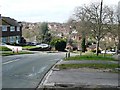
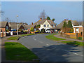

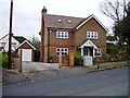
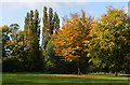


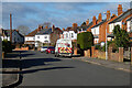
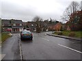
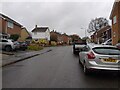
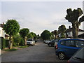
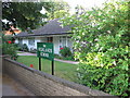
55 photos from this area
Area Information
Key information about the RG31 5EB including its size, population, and administrative classification.
- Area Type
- Postcode
- Area Size
- 2.2 hectares
- Population
- 1492
- Population Density
- 5104 people/km²
House Prices in RG31 5EB
40
Properties
£274,329
Average Sold Price
£59,000
Lowest Price
£543,000
Highest Price
Showing 40 properties
| Address | Type | Beds | Baths | Last Sale Price | Last Sale Date | |
|---|---|---|---|---|---|---|
| 52 Lower Elmstone Drive, Tilehurst, Reading, RG31 5EB | Maisonette | - | - | £150,000 | Jun 2025 | |
| 54 Lower Elmstone Drive, Tilehurst, Reading, RG31 5EB | Maisonette | 2 | 1 | £205,000 | Oct 2024 | |
| 46 Lower Elmstone Drive, Tilehurst, Reading, RG31 5EB | Retail | 2 | 1 | £217,500 | Apr 2022 | |
| 9 Lower Elmstone Drive, Tilehurst, Reading, RG31 5EB | Bungalow | - | - | £320,000 | Mar 2021 | |
| 11 Lower Elmstone Drive, Tilehurst, Reading, RG31 5EB | Detached | 3 | 1 | £435,000 | Oct 2020 | |
| 45 Lower Elmstone Drive, Tilehurst, Reading, RG31 5EB | Detached | 3 | 2 | £390,000 | Sep 2020 | |
| 36 Lower Elmstone Drive, Tilehurst, Reading, RG31 5EB | Detached | 3 | 2 | £395,000 | Sep 2019 | |
| 26A Lower Elmstone Drive, Tilehurst, Reading, RG31 5EB | Detached | 4 | 2 | £543,000 | Aug 2019 | |
| 43 Lower Elmstone Drive, Tilehurst, Reading, RG31 5EB | Detached | 4 | 1 | £380,000 | Aug 2019 | |
| 51 Lower Elmstone Drive, Tilehurst, Reading, RG31 5EB | Detached | 4 | 2 | £380,000 | May 2017 |
Page 1 of 4
Energy Efficiency in RG31 5EB
Amenities
Schools
| Rank | School | Type | Entry gender | Ages |
|---|
Explore more schools in this area
Go to Schools tabDemographics
Household Size
Family (3-5 people)
most common
Accommodation Type
Houses
most common
Tenure
86
majority
Ethnic Group
White
most common
Religion
N/A
most common
Household Composition
N/A
most common
Age
47
median
Adults (30-64 years)
most common
Household Deprivation
N/A
with no deprivation
NS-SEC
39
in Lower managerial occupations
Explore more demographic insights in this area
Go to Demographics tabPlanning
Planning Constraints
- Flood RiskPremium
- Ramsar Wetland SitesPremium
- Area of Outstanding Natural BeautyPremium
- Protected Nature ReservePremium
- Protected WoodlandPremium