Area Overview for RG31 4TA
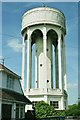
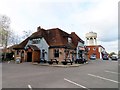
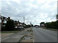
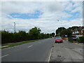
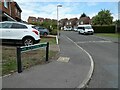
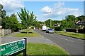
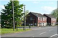
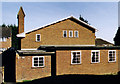
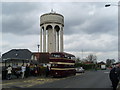
Photos of RG31 4TA
Area Information
RG31 4TA represents a specific postcode covering a small residential cluster in Berkshire. You are looking at a compact area spanning just 2.4 hectares, home to a population of 1 534 people. This density creates a tight-knit environment where neighbours are likely to know one another within minutes of returning home. The population density stands at 63 357 people per square kilometre, which indicates a fully developed zone rather than a rural or semi-rural setting. Living in RG31 4TA means joining a community where every street corner and shared space contributes significantly to the area's character. There is no vast open land to explore within the postcode boundaries itself, but the location serves as a convenient hub for the wider Reading and District savings bank regions nearby. The area functions as a practical residential slice of a larger metropolitan fringe, offering immediate access to established infrastructure while maintaining a concentrated footprint. You will find that daily life here is defined by proximity to essential services and a reliance on the surrounding towns for broader leisure activities. The small size of the postcode ensures that local management of shared resources is straightforward for any community group.
- Area Type
- Postcode
- Area Size
- 2.4 hectares
- Population
- 1534
- Population Density
- 1609 people/km²
Homes in RG31 4TA are characterised by a strong market for owner-occupiers rather than investors or landlords. With 85% of the property stock owned outright or via mortgage, the area functions as a stable residential zone where existing owners live through the life cycle of their homes. The predominant accommodation type is houses, meaning you will not find the high-rise flats or terraced rows typical of urban rental sectors. This concentration of single-family dwellings implies that buyers are likely seeking detached, semi-detached, or large properties suitable for families. The market here is not driven by transient tenancies but by residents who have put down roots in this specific 2.4-hectare footprint. When you look at properties within RG31 4TA, you should expect to engage with owners who value the quiet nature of the area. The high ownership percentage also means that service charges and collective maintenance issues related to blocks of flats are largely non-existent in this locality. Buyers should approach this postcode as a straightforward residential purchase environment where the primary focus is on individual house value rather than collective building performance.
House Prices in RG31 4TA
Showing 67 properties
| Address | Type | Beds | Baths | Last Sale Price | Last Sale Date | |
|---|---|---|---|---|---|---|
| 54 Curlew Drive, Tilehurst, Reading, RG31 4TA | Terraced | 3 | 1 | £370,000 | Aug 2025 | |
| 40 Curlew Drive, Tilehurst, Reading, RG31 4TA | Terraced | 3 | 1 | £380,000 | May 2025 | |
| 38 Curlew Drive, Tilehurst, Reading, RG31 4TA | Terraced | 3 | 2 | £400,000 | Apr 2024 | |
| 2 Curlew Drive, Tilehurst, Reading, RG31 4TA | Semi-detached | 3 | 2 | £416,000 | Feb 2024 | |
| 4 Curlew Drive, Tilehurst, Reading, RG31 4TA | Semi-detached | 3 | 1 | £450,000 | Nov 2023 | |
| 33 Curlew Drive, Tilehurst, Reading, RG31 4TA | Semi-detached | 3 | 1 | £425,000 | Jul 2023 | |
| 61 Curlew Drive, Tilehurst, Reading, RG31 4TA | Terraced | 3 | 1 | £340,000 | May 2022 | |
| 42 Curlew Drive, Tilehurst, Reading, RG31 4TA | Terraced | 3 | 1 | £378,000 | Jun 2021 | |
| 19 Curlew Drive, Tilehurst, Reading, RG31 4TA | Semi-detached | 3 | 2 | £380,000 | May 2021 | |
| 17 Curlew Drive, Tilehurst, Reading, RG31 4TA | house | - | - | £340,000 | Dec 2020 |
Energy Efficiency in RG31 4TA
Living in RG31 4TA places you within practical reach of several key amenities that simplify daily life. For your shopping needs, Sainsburys Calcot, Co-op The Triangle, and Asda Tilehurst School are among the five major retail venues nearby. These stores provide everything from fresh groceries to household essentials, meaning you rarely need to travel far for routine purchases. On the transport front, your five nearest railway stations include Theale Railway Station, Tilehurst Railway Station, and Reading West Railway Station. These hubs connect you to wider travel networks quickly, reducing the time spent commuting to larger city centres. While the data does not detail specific parks or leisure centres, the proximity to significant retail and rail infrastructure implies a lifestyle focused on convenience and accessibility. You can access dining and leisure options in the adjacent towns without a lengthy drive after work. The layout of these amenities around the 2.4-hectare postal area suggests a model where daily errands are completed quickly. This concentration of retail and rail nodes ensures that your time is not wasted on unnecessary travel, allowing more hours for family time or personal interests.
Amenities
Schools
For families planning to settle in RG31 4TA, your nearest educational options are well-established institutions with good Ofsted ratings. Springfield Primary School operates as a primary school for children in this catchment area and holds a "good" Ofsted rating. St Paul's Catholic Primary School is the second key option available to you, also rated "good" by inspectors. Both schools serve as essential supports for the local community, providing free education for primary-aged children living in the immediate vicinity. The mix of two primary schools suggests sufficient capacity for local pupils without the need to travel long distances to secondary institutions. Because the data provided does not list secondary schools, you must assume that high school choices require commuting to nearby larger towns like Reading or Crowthorne. The presence of two "good" rated primary schools near RG31 4TA significantly enhances the area's appeal for parents prioritising education quality. These schools have proven track records, which often translates into stable support systems and consistent academic standards for the students who attend them daily.
| Rank | School | Type | Entry gender | Ages |
|---|
Explore more schools in this area
Go to Schools tabDemographics
The community within RG31 4TA is defined by its mature residential base. You will find that 85% of households are owner-occupied, indicating a high level of stability and long-term permanence among the residents. The most common age range for occupants falls between 30 and 64 years, with a median age of 47 years. This demographic profile suggests the area attracts families and professionals in their working years rather than students or the very young. The predominant ethnic group is White, reflecting the consistent historical development of the housing stock in this part of Berkshire. Although the area consists almost entirely of houses, the high ownership rate means you will rarely encounter rental properties on your next door-to-door inspection of the streets. This demographic makeup supports local businesses that cater to established families, from specialist tradespeople to family-friendly essential retailers. The absence of a significant student population or seasonal workforce means the local noise levels and traffic patterns remain relatively consistent throughout the year. Residents here have tended to remain in their homes for extended periods, which fosters a sense of established community ownership and local stewardship.
Household Size
Accommodation Type
Tenure
Ethnic Group
Religion
Household Composition
Age
Household Deprivation
NS-SEC
Explore more demographic insights in this area
Go to Demographics tabPlanning
Planning Constraints
- Flood RiskPremium
- Ramsar Wetland SitesPremium
- Area of Outstanding Natural BeautyPremium
- Protected Nature ReservePremium
- Protected WoodlandPremium