Area Overview for RG30 6AL
Photos of RG30 6AL

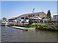

95 photos from this area
Area Information
Key information about the RG30 6AL including its size, population, and administrative classification.
- Area Type
- Postcode
- Area Size
- 1.0 hectares
- Population
- 1539
- Population Density
- 5457 people/km²
House Prices in RG30 6AL
28
Properties
£245,868
Average Sold Price
£72,250
Lowest Price
£355,000
Highest Price
Showing 28 properties
| Address | Type | Beds | Baths | Last Sale Price | Last Sale Date | |
|---|---|---|---|---|---|---|
| 34 Broomfield Road, Tilehurst, Reading, RG30 6AL | Detached | 3 | 1 | £345,000 | Feb 2025 | |
| 64 Broomfield Road, Tilehurst, Reading, RG30 6AL | Terraced | 3 | 1 | £318,000 | Oct 2023 | |
| 52 Broomfield Road, Tilehurst, Reading, RG30 6AL | Terraced | 3 | 1 | £282,000 | Sep 2023 | |
| 44 Broomfield Road, Tilehurst, Reading, RG30 6AL | house | - | - | £285,000 | Dec 2021 | |
| 28 Broomfield Road, Tilehurst, Reading, RG30 6AL | house | - | - | £355,000 | Mar 2021 | |
| 14 Broomfield Road, Tilehurst, Reading, RG30 6AL | Detached | 4 | 1 | £355,000 | Dec 2020 | |
| 26 Broomfield Road, Tilehurst, Reading, RG30 6AL | Semi-detached | 3 | 1 | £350,000 | Sep 2019 | |
| 36 Broomfield Road, Tilehurst, Reading, RG30 6AL | house | - | - | £330,000 | Jul 2016 | |
| 24 Broomfield Road, Tilehurst, Reading, RG30 6AL | Detached | 3 | - | £320,000 | Apr 2015 | |
| 16 Broomfield Road, Tilehurst, Reading, RG30 6AL | Detached | 4 | 1 | £250,000 | Sep 2013 |
Page 1 of 3
Energy Efficiency in RG30 6AL
Amenities
Schools
| Rank | School | Type | Entry gender | Ages |
|---|
Explore more schools in this area
Go to Schools tabDemographics
Household Size
Family (3-5 people)
most common
Accommodation Type
Houses
most common
Tenure
61
majority
Ethnic Group
White
most common
Religion
N/A
most common
Household Composition
N/A
most common
Age
47
median
Adults (30-64 years)
most common
Household Deprivation
N/A
with no deprivation
NS-SEC
27
in Lower managerial occupations
Explore more demographic insights in this area
Go to Demographics tabPlanning
Planning Constraints
- Flood RiskPremium
- Ramsar Wetland SitesPremium
- Area of Outstanding Natural BeautyPremium
- Protected Nature ReservePremium
- Protected WoodlandPremium