Area Overview for RG30 4XB
Photos of RG30 4XB
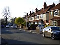
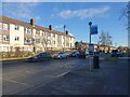
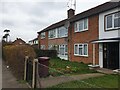
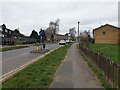
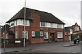
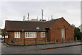
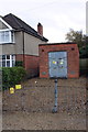

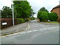
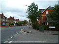
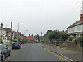
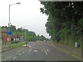
42 photos from this area
Area Information
Key information about the RG30 4XB including its size, population, and administrative classification.
- Area Type
- Postcode
- Area Size
- 1.2 hectares
- Population
- 1477
- Population Density
- 5050 people/km²
House Prices in RG30 4XB
25
Properties
£222,536
Average Sold Price
£76,950
Lowest Price
£425,000
Highest Price
Showing 25 properties
| Address | Type | Beds | Baths | Last Sale Price | Last Sale Date | |
|---|---|---|---|---|---|---|
| 34 Chichester Road, Tilehurst, Reading, RG30 4XB | Semi-detached | 4 | 2 | £425,000 | Jan 2023 | |
| 70 Chichester Road, Tilehurst, Reading, RG30 4XB | Terraced | 3 | 1 | £300,000 | Apr 2022 | |
| 64 Chichester Road, Tilehurst, Reading, RG30 4XB | Terraced | 3 | 1 | £320,000 | Apr 2021 | |
| 38 Chichester Road, Tilehurst, Reading, RG30 4XB | Detached | 4 | 1 | £350,000 | Dec 2019 | |
| 74 Chichester Road, Tilehurst, Reading, RG30 4XB | house | - | - | £240,074 | Mar 2014 | |
| 62 Chichester Road, Tilehurst, Reading, RG30 4XB | Terraced | 3 | 1 | £180,000 | Nov 2012 | |
| 44 Chichester Road, Tilehurst, Reading, RG30 4XB | house | - | - | £170,000 | Jul 2011 | |
| 68 Chichester Road, Tilehurst, Reading, RG30 4XB | house | - | - | £175,000 | Oct 2009 | |
| 36 Chichester Road, Tilehurst, Reading, RG30 4XB | Semi-detached | - | - | £249,950 | Nov 2007 | |
| 56 Chichester Road, Tilehurst, Reading, RG30 4XB | Terraced | - | - | £187,000 | Jul 2007 |
Page 1 of 3
Energy Efficiency in RG30 4XB
Amenities
Schools
| Rank | School | Type | Entry gender | Ages |
|---|
Explore more schools in this area
Go to Schools tabDemographics
Household Size
Family (3-5 people)
most common
Accommodation Type
Houses
most common
Tenure
69
majority
Ethnic Group
White
most common
Religion
N/A
most common
Household Composition
N/A
most common
Age
47
median
Adults (30-64 years)
most common
Household Deprivation
N/A
with no deprivation
NS-SEC
35
in Lower managerial occupations
Explore more demographic insights in this area
Go to Demographics tabPlanning
Planning Constraints
- Flood RiskPremium
- Ramsar Wetland SitesPremium
- Area of Outstanding Natural BeautyPremium
- Protected Nature ReservePremium
- Protected WoodlandPremium