Area Overview for RG30 4RY
Photos of RG30 4RY


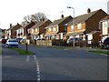
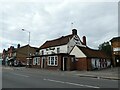
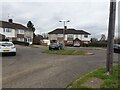
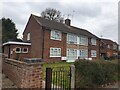

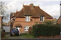
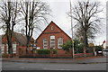
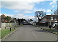
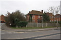
38 photos from this area
Area Information
Key information about the RG30 4RY including its size, population, and administrative classification.
- Area Type
- Postcode
- Area Size
- 1.5 hectares
- Population
- 1538
- Population Density
- 4750 people/km²
House Prices in RG30 4RY
27
Properties
£340,083
Average Sold Price
£89,500
Lowest Price
£546,000
Highest Price
Showing 27 properties
| Address | Type | Beds | Baths | Last Sale Price | Last Sale Date | |
|---|---|---|---|---|---|---|
| 111A St Michaels Road, Tilehurst, Reading, RG30 4RY | Bungalow | 2 | 1 | £430,000 | Feb 2025 | |
| 79 St Michaels Road, Tilehurst, Reading, RG30 4RY | Semi-detached | 4 | 2 | £450,000 | Oct 2022 | |
| 103 St Michaels Road, Tilehurst, Reading, RG30 4RY | Retail | 3 | 1 | £430,000 | Sep 2022 | |
| 111 St Michaels Road, Tilehurst, Reading, RG30 4RY | Bungalow | - | - | £540,000 | Sep 2021 | |
| 77 St Michaels Road, Tilehurst, Reading, RG30 4RY | Semi-detached | 3 | 1 | £546,000 | Mar 2021 | |
| 85 St Michaels Road, Tilehurst, Reading, RG30 4RY | house | - | - | £380,000 | Feb 2021 | |
| 107 St Michaels Road, Tilehurst, Reading, RG30 4RY | Detached | 4 | 2 | £440,000 | Oct 2018 | |
| 105 St Michaels Road, Tilehurst, Reading, RG30 4RY | house | - | - | £440,000 | Jan 2017 | |
| 113 St Michaels Road, Tilehurst, Reading, RG30 4RY | Bungalow | - | - | £450,000 | Dec 2014 | |
| 89 St Michaels Road, Tilehurst, Reading, RG30 4RY | Semi-detached | 3 | 2 | £365,000 | Jan 2014 |
Page 1 of 3
Energy Efficiency in RG30 4RY
Amenities
Schools
| Rank | School | Type | Entry gender | Ages |
|---|
Explore more schools in this area
Go to Schools tabDemographics
Household Size
Family (3-5 people)
most common
Accommodation Type
Houses
most common
Tenure
57
majority
Ethnic Group
White
most common
Religion
N/A
most common
Household Composition
N/A
most common
Age
47
median
Adults (30-64 years)
most common
Household Deprivation
N/A
with no deprivation
NS-SEC
28
in Lower managerial occupations
Explore more demographic insights in this area
Go to Demographics tabPlanning
Planning Constraints
- Flood RiskPremium
- Ramsar Wetland SitesPremium
- Area of Outstanding Natural BeautyPremium
- Protected Nature ReservePremium
- Protected WoodlandPremium