Area Overview for RG30 4PB
Photos of RG30 4PB
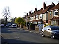
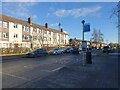
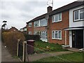
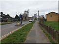
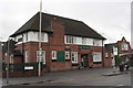
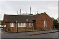

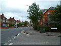
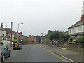
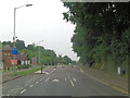
42 photos from this area
Area Information
Key information about the RG30 4PB including its size, population, and administrative classification.
- Area Type
- Postcode
- Area Size
- 5333 m²
- Population
- 1538
- Population Density
- 4750 people/km²
House Prices in RG30 4PB
18
Properties
£212,983
Average Sold Price
£59,950
Lowest Price
£335,000
Highest Price
Showing 18 properties
| Address | Type | Beds | Baths | Last Sale Price | Last Sale Date | |
|---|---|---|---|---|---|---|
| 302 The Meadway, Tilehurst, Reading, RG30 4PB | Semi-detached | 3 | 1 | £335,000 | Mar 2021 | |
| 312 The Meadway, Tilehurst, Reading, RG30 4PB | house | - | - | £300,000 | Jun 2019 | |
| 314 The Meadway, Tilehurst, Reading, RG30 4PB | house | - | - | £277,000 | Jul 2015 | |
| 300 The Meadway, Tilehurst, Reading, RG30 4PB | Semi-detached | - | - | £236,000 | May 2007 | |
| 318 The Meadway, Tilehurst, Reading, RG30 4PB | Terraced | 3 | 1 | £69,950 | Sep 1996 | |
| 316 The Meadway, Tilehurst, Reading, RG30 4PB | Terraced | - | - | £59,950 | Feb 1995 | |
| 320A The Meadway, Tilehurst, Reading, RG30 4PB | Flat | - | - | - | - | |
| 320 The Meadway, Tilehurst, Reading, RG30 4PB | Flat | - | - | - | - | |
| 306A The Meadway, Tilehurst, Reading, RG30 4PB | Flat | - | - | - | - | |
| 306 The Meadway, Tilehurst, Reading, RG30 4PB | Flat | - | - | - | - |
Page 1 of 2
Energy Efficiency in RG30 4PB
Amenities
Schools
| Rank | School | Type | Entry gender | Ages |
|---|
Explore more schools in this area
Go to Schools tabDemographics
Household Size
Family (3-5 people)
most common
Accommodation Type
Houses
most common
Tenure
57
majority
Ethnic Group
White
most common
Religion
N/A
most common
Household Composition
N/A
most common
Age
47
median
Adults (30-64 years)
most common
Household Deprivation
N/A
with no deprivation
NS-SEC
28
in Lower managerial occupations
Explore more demographic insights in this area
Go to Demographics tabPlanning
Planning Constraints
- Flood RiskPremium
- Ramsar Wetland SitesPremium
- Area of Outstanding Natural BeautyPremium
- Protected Nature ReservePremium
- Protected WoodlandPremium