Area Overview for RG30 3TN
Photos of RG30 3TN
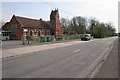
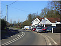
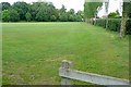
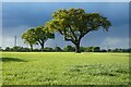
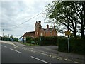
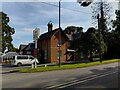
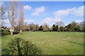
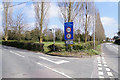
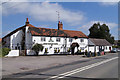
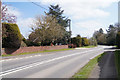
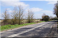
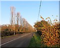
17 photos from this area
Area Information
Key information about the RG30 3TN including its size, population, and administrative classification.
- Area Type
- Postcode
- Area Size
- 10.8 hectares
- Population
- 1429
- Population Density
- 95 people/km²
House Prices in RG30 3TN
31
Properties
£462,553
Average Sold Price
£162,500
Lowest Price
£800,000
Highest Price
Showing 31 properties
| Address | Type | Beds | Baths | Last Sale Price | Last Sale Date | |
|---|---|---|---|---|---|---|
| Langstrath, Theale Road, Burghfield, Reading, RG30 3TN | Bungalow | - | - | £725,000 | Feb 2020 | |
| Nellina, Theale Road, Burghfield, Reading, RG30 3TN | Bungalow | 4 | 4 | £445,000 | Jun 2019 | |
| Greenways, Theale Road, Burghfield, Reading, RG30 3TN | Detached | 5 | 3 | £800,000 | Dec 2018 | |
| The Homestead, Theale Road, Burghfield, Reading, RG30 3TN | Bungalow | 5 | 2 | £565,008 | Nov 2017 | |
| Badgers Holt, Theale Road, Burghfield, Reading, RG30 3TN | Semi-detached | 4 | 2 | £445,000 | Jun 2017 | |
| Lynton, Theale Road, Burghfield, Reading, RG30 3TN | Semi-detached | 3 | 2 | £450,000 | Mar 2016 | |
| Meadow Rue, Theale Road, Burghfield, Reading, RG30 3TN | house | - | - | £725,000 | Sep 2015 | |
| Cartref, Theale Road, Burghfield, Reading, RG30 3TN | Bungalow | 3 | - | £290,500 | Aug 2014 | |
| Ridgewell House, Theale Road, Burghfield, Reading, RG30 3TN | Semi-detached | 4 | - | £390,000 | Jul 2013 | |
| Clovers Edge, Theale Road, Burghfield, Reading, RG30 3TN | Detached | 5 | - | £650,000 | Feb 2012 |
Page 1 of 4
Energy Efficiency in RG30 3TN
Amenities
Schools
| Rank | School | Type | Entry gender | Ages |
|---|
Explore more schools in this area
Go to Schools tabDemographics
Household Size
Two person
most common
Accommodation Type
Houses
most common
Tenure
81
majority
Ethnic Group
White
most common
Religion
N/A
most common
Household Composition
N/A
most common
Age
47
median
Adults (30-64 years)
most common
Household Deprivation
N/A
with no deprivation
NS-SEC
50
in Lower managerial occupations
Explore more demographic insights in this area
Go to Demographics tabPlanning
Planning Constraints
- Flood RiskPremium
- Ramsar Wetland SitesPremium
- Area of Outstanding Natural BeautyPremium
- Protected Nature ReservePremium
- Protected WoodlandPremium