Area Overview for RG30 2TL
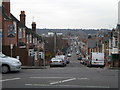
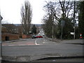
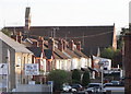
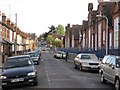
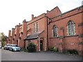
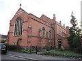
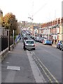
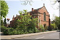
Photos of RG30 2TL
Area Information
Write an engaging overview of living in RG30 2TL. Cover what makes this area distinctive, who lives here, and what daily life is like. Weave in the population, area size, and any background context naturally. This is the first thing a prospective homebuyer reads — make it count.
- Area Type
- Postcode
- Area Size
- 6773 m²
- Population
- 1802
- Population Density
- 8951 people/km²
Write about the property market in RG30 2TL. Use the home ownership percentage and accommodation type data to paint a picture of the housing stock. Describe whether this is primarily an owner-occupied area or a rental market, what types of homes predominate, and what this means for buyers looking at this small area and its immediate surroundings.
House Prices in RG30 2TL
Showing 38 properties
| Address | Type | Beds | Baths | Last Sale Price | Last Sale Date | |
|---|---|---|---|---|---|---|
| 145 Elm Park Road, Reading, RG30 2TL | Terraced | 2 | 1 | £325,000 | May 2024 | |
| 127 Elm Park Road, Reading, RG30 2TL | house | - | - | £350,000 | Nov 2022 | |
| 133 Elm Park Road, Reading, RG30 2TL | house | - | - | £253,500 | Jun 2021 | |
| 135 Elm Park Road, Reading, RG30 2TL | Terraced | 5 | 2 | £241,000 | Mar 2021 | |
| 171 Elm Park Road, Reading, RG30 2TL | Terraced | 3 | 1 | £320,000 | Apr 2020 | |
| 173 Elm Park Road, Reading, RG30 2TL | Terraced | 3 | 1 | £300,000 | Jan 2020 | |
| 125 Elm Park Road, Reading, RG30 2TL | Terraced | 3 | 1 | £216,000 | May 2019 | |
| 161 Elm Park Road, Reading, RG30 2TL | Terraced | 3 | 1 | £335,000 | Aug 2018 | |
| 103 Elm Park Road, Reading, RG30 2TL | Terraced | 3 | 1 | £285,000 | Jul 2018 | |
| 115 Elm Park Road, Reading, RG30 2TL | Terraced | 3 | 1 | £314,786 | May 2017 |
Energy Efficiency in RG30 2TL
Describe the lifestyle and amenities accessible to residents of RG30 2TL. These are the nearest amenities within practical reach — name specific venues from the data. Cover shops, dining, parks, leisure, and other facilities. Describe the character and convenience these amenities bring to daily life in the area.
Amenities
Schools
Cover the schools nearest to RG30 2TL. Name each school, state its type and Ofsted rating. Explain what the mix of school types means for families. Only reference schools listed in the data — do not invent or guess school names.
| Rank | School | Type | Entry gender | Ages |
|---|
Explore more schools in this area
Go to Schools tabDemographics
Describe the community in RG30 2TL. Cover the age profile, household types, home ownership levels, accommodation types, and diversity using the exact figures provided. Present deprivation data in context — explain what it means for quality of life. Every claim must reference a specific number from the data.
Household Size
Accommodation Type
Tenure
Ethnic Group
Religion
Household Composition
Age
Household Deprivation
NS-SEC
Explore more demographic insights in this area
Go to Demographics tabPlanning
Planning Constraints
- Flood RiskPremium
- Ramsar Wetland SitesPremium
- Area of Outstanding Natural BeautyPremium
- Protected Nature ReservePremium
- Protected WoodlandPremium