Area Overview for RG30 2RA
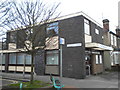
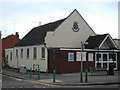
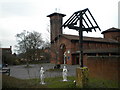
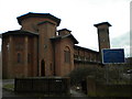
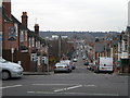
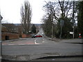
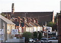
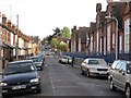
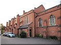
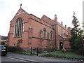
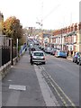
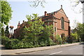
Photos of RG30 2RA
Area Information
RG30 2RA is a compact residential cluster covering 6253 m² in England. With a population of 1703, this postcode serves as a dense housing node rather than a sprawling neighbourhood. The area sits within the RG30 post town, which envelopes parts of Reading and surrounding districts. Daily life here centres on proximity to major transport hubs and local retail chains. You will find yourself embedded in a community where house ownership is significant, suggesting stability for long-term residents. The high population density means streets are closely packed, creating an environment where neighbours interact frequently. This physical compactness defines the pace of life in RG30 2RA, where commuting to Reading or Bracknell is often quick via nearby rail links. The area functions as a practical base for workers accessing the wider South East economy. Residents enjoy ready access to essential services without needing to travel far into town centres. The demographic profile indicates an older population, which shapes the character of local interactions and community groups. Living in RG30 2RA offers a straightforward locality where practical needs are met immediately. You are surrounded by established homes rather than new developments under construction. The small land size means the area has reached a natural saturation point for housing within its boundaries.
- Area Type
- Postcode
- Area Size
- 6253 m²
- Population
- 1703
- Population Density
- 7877 people/km²
The housing stock in RG30 2RA is defined by a mix of owner-occupied homes and a relatively balanced rental presence. Exactly 49% of residents own their homes, which means half the households are tenants. You are unlikely to find high-rise apartments here; the dominant accommodation type is houses. This distinction places the area firmly in the single-family home sector, typical of residential clusters near Reading. The small area size of 6253 m² limits supply, making existing properties the main option for buyers. Home values likely reflect the demand for freehold houses in established neighbourhoods rather than new-build opportunities. The area does not cater primarily to young professionals seeking flats or students looking for hundreds of rental units. Instead, the market serves families or individuals seeking a traditional house with a garden or driveway. The 49% ownership split indicates a healthy turnover rate for homes in RG30 2RA. Buyers often compete directly with sellers who intend to remain in the area for the long term. The property market here operates differently than in dense urban districts where flats dominate the skyline.
House Prices in RG30 2RA
Showing 40 properties
| Address | Type | Beds | Baths | Last Sale Price | Last Sale Date | |
|---|---|---|---|---|---|---|
| 55 Beecham Road, Reading, RG30 2RA | Terraced | 3 | 1 | £322,500 | Sep 2025 | |
| 45 Beecham Road, Reading, RG30 2RA | Terraced | 2 | 1 | £340,000 | Mar 2025 | |
| 39 Beecham Road, Reading, RG30 2RA | Terraced | 3 | 1 | £298,500 | Aug 2024 | |
| 61 Beecham Road, Reading, RG30 2RA | Terraced | 2 | 1 | £310,000 | Jun 2024 | |
| 29 Beecham Road, Reading, RG30 2RA | Terraced | 3 | 1 | £335,000 | Aug 2022 | |
| 21 Beecham Road, Reading, RG30 2RA | house | - | - | £290,000 | Dec 2021 | |
| 33 Beecham Road, Reading, RG30 2RA | house | - | - | £281,850 | Aug 2021 | |
| 63 Beecham Road, Reading, RG30 2RA | Semi-detached | 4 | 1 | £310,500 | Nov 2020 | |
| 3 Beecham Road, Reading, RG30 2RA | Terraced | 3 | 1 | £290,888 | Jun 2016 | |
| 23 Beecham Road, Reading, RG30 2RA | Terraced | 2 | 2 | £241,000 | Mar 2016 |
Energy Efficiency in RG30 2RA
Residents of RG30 2RA benefit from immediate access to five retail units and five railway stations within practical reach. Tesco Reading W offers a major supermarket option for grocery shopping. You will also find Spar and Lidl West nearby, providing variety for everyday food needs. Your daily shopping trips require minimal travel time from your front door. Railway connectivity is robust, with Reading West Railway Station, Tilehurst Railway Station, and Reading Railway Station all located close by. These five rail stations offer direct links to Reading town centre and beyond, connecting you to the broader national network. The proximity to Reading Railway Station, in particular, provides easy access to jobs and leisure destinations across Berkshire and London. Living in RG30 2RA means your weekly errands are handled efficiently without traffic congestion. The combination of multiple supermarkets and high-frequency rail services creates a convenient lifestyle. You can manage household budgets and commute schedules with precision thanks to these well-positioned amenities.
Amenities
Schools
Parents in RG30 2RA have access to Wilson Primary School, which holds a good Ofsted rating. This primary institution serves young children living within the postcode boundary. No secondary schools are listed in the immediate vicinity of RG30 2RA, meaning families must commute for junior and senior education. The presence of a single primary school suggests a localized catchment area for early years education. Schools near RG30 2RA are limited to this one option within the defined cluster. You will need to research secondary choices beyond the immediate RG30 2RA cluster if children progress past age 11. Wilson Primary School provides a solid educational foundation for local children with its good rating. The concentration of schools is low relative to the population of 1703, indicating a reliance on the wider Reading network for older students. This situation is common in outer residential pockets where the primary population starts education locally before moving elsewhere.
| Rank | School | Type | Entry gender | Ages |
|---|
Explore more schools in this area
Go to Schools tabDemographics
The community in RG30 2RA is dominated by adults between the ages of 30 and 64 years. This age range represents the most common demographic, with a median age of 47 indicating a mature population. Nearly half of all households own their property, with a home ownership rate of 49%. You will encounter mostly independent homeowners who have likely lived in the area for many years. Houses constitute the primary accommodation type, meaning you are looking at detached or semi-detached structures rather than flats. The predominant ethnic group is White, reflecting the broader suburban character of the RG30 post town. This demographic consistency suggests a cohesive social fabric where long-standing residents form the core of the neighbourhood. Older adults and families with school-aged children likely make up the majority of those you meet. The high rate of homeownership points to an area where people stay put rather than renting transiently. You can expect a stable environment where community decisions and local events attract consistent participation. The demographic picture supports a quieter atmosphere suited for settled families or retirees seeking a familiar pace of life. Living in RG30 2RA means joining a community defined by its mature resident base and strong property ownership.
Household Size
Accommodation Type
Tenure
Ethnic Group
Religion
Household Composition
Age
Household Deprivation
NS-SEC
Explore more demographic insights in this area
Go to Demographics tabPlanning
Planning Constraints
- Flood RiskPremium
- Ramsar Wetland SitesPremium
- Area of Outstanding Natural BeautyPremium
- Protected Nature ReservePremium
- Protected WoodlandPremium