Area Overview for RG30 1EG
Photos of RG30 1EG


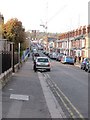
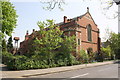
100 photos from this area
Area Information
Key information about the RG30 1EG including its size, population, and administrative classification.
- Area Type
- Postcode
- Area Size
- 1.2 hectares
- Population
- 2809
- Population Density
- 1863 people/km²
House Prices in RG30 1EG
89
Properties
£272,533
Average Sold Price
£54,950
Lowest Price
£3,415,550
Highest Price
Showing 89 properties
| Address | Type | Beds | Baths | Last Sale Price | Last Sale Date | |
|---|---|---|---|---|---|---|
| 516 Oxford Road, Reading, RG30 1EG | house | - | - | £325,000 | Jul 2025 | |
| 540 Oxford Road, Reading, RG30 1EG | Flat | 1 | 1 | £3,415,550 | Dec 2024 | |
| 520 Oxford Road, Reading, RG30 1EG | Terraced | 2 | 1 | £275,000 | Oct 2024 | |
| 606 Oxford Road, Reading, RG30 1EG | Terraced | 2 | 2 | £270,000 | Apr 2024 | |
| 574 Oxford Road, Reading, RG30 1EG | house | 3 | 1 | £229,000 | Nov 2023 | |
| 580 Oxford Road, Reading, RG30 1EG | Terraced | 3 | 1 | £283,000 | Sep 2023 | |
| 514 Oxford Road, Reading, RG30 1EG | house | - | - | £252,000 | Jun 2022 | |
| 628 Oxford Road, Reading, RG30 1EG | Terraced | 3 | 1 | £275,000 | May 2022 | |
| 592 Oxford Road, Reading, RG30 1EG | Terraced | 3 | 1 | £242,500 | Dec 2021 | |
| 586 Oxford Road, Reading, RG30 1EG | Terraced | 3 | 1 | £205,000 | Oct 2021 |
Page 1 of 9
Energy Efficiency in RG30 1EG
Amenities
Schools
| Rank | School | Type | Entry gender | Ages |
|---|
Explore more schools in this area
Go to Schools tabDemographics
Household Size
Family (3-5 people)
most common
Accommodation Type
Houses
most common
Tenure
48
majority
Ethnic Group
White
most common
Religion
N/A
most common
Household Composition
N/A
most common
Age
47
median
Adults (30-64 years)
most common
Household Deprivation
N/A
with no deprivation
NS-SEC
31
in Lower managerial occupations
Explore more demographic insights in this area
Go to Demographics tabPlanning
Planning Constraints
- Flood RiskPremium
- Ramsar Wetland SitesPremium
- Area of Outstanding Natural BeautyPremium
- Protected Nature ReservePremium
- Protected WoodlandPremium