Area Overview for RG3 1JD
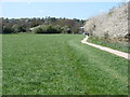
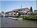
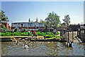
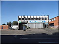
Photos of RG3 1JD
Area Information
RG3 1JD is a specific postcode area covering a small residential cluster in England. This compact location houses a population of 1797 people, creating a tightly knit environment rather than a sprawling suburb. The area falls within the RG3 postcode district, which typically serves the Tilehurst and surrounding regions. Living in RG3 1JD means you are situated in a neighbourhood designed for resident convenience. The small size of the cluster means you are never far from daily necessities. This postcode represents a distinct slice of the Reading hinterland, offering a focused living experience. Residents here enjoy a clear sense of locality without the density of the city centre. The residential nature of the site ensures that streets remain primarily for homes. Your daily life revolves around this well-defined community boundary. Understanding the scale of RG3 1JD helps you visualise your future home. It is a place defined by its specific boundaries and its small, contained population size.
- Area Type
- Postcode
- Area Size
- Not available
- Population
- 1797
- Population Density
- 7696 people/km²
The property market in RG3 1JD is characterised by a strong preference for single-family living. Houses account for the majority of the accommodation stock, catering to those seeking privacy and garden space. With a home ownership level of 38%, nearly four out of ten residents hold title to their dwellings. This rate indicates a balanced market where both owners and tenants coexist, though ownership remains a significant force. The small residential cluster nature of RG3 1JD limits the variety of housing types compared to larger urban zones. Buyers looking at homes in this postcode should expect a selection of detached or semi-detached properties. The accommodation type data confirms that flats and purpose-built apartments are not the primary feature here. This housing pattern appeals to established buyers who value space and land. When searching for RG3 1JD real estate, your focus will naturally lean towards traditional family homes. The market dynamics reflect a stable, residential zone rather than a high-density investment hub.
House Prices in RG3 1JD
No properties found in this postcode.
Energy Efficiency in RG3 1JD
Daily life in RG3 1JD benefits from immediate access to essential retail and railway services. Five retail outlets operate within practical reach of your home. You can shop at Waitrose Reading, Spar, and Tesco Reading W for groceries and household essentials. This разнообразie of nearby amenities ensures you do not need to travel far for weekly shopping. Five rail stations provide convenient access to wider travel networks. Tilehurst Railway Station, Reading West Railway Station, and Reading Railway Station are all options for your commute. These stations simplify travel to London and other regional destinations. The combination of local supermarkets and mainline rail infrastructure creates a self-sufficient lifestyle. You can manage your home life efficiently while maintaining easy access to the broader region. Living in RG3 1JD offers the practicality of local services alongside the connectivity of national transport links.
Amenities
Schools
| Rank | School | Type | Entry gender | Ages |
|---|
Explore more schools in this area
Go to Schools tabDemographics
The community in RG3 1JD reflects a mature household profile. The median age stands at 47, indicating that families and professionals in the prime earning years dominate the population. Adults aged between 30 and 64 years constitute the most common age range within this postcode. This demographic skew suggests a stable neighbourhood where long-term residents often stay. Home ownership rates sit at 38%, meaning a significant portion of the 1797 residents own their properties outright or with a mortgage. The remaining households likely rely on rental agreements or other tenure types. Houses form the predominant accommodation type, aligning with the needs of families and established adults. Ethnically, White residents make up the largest group, contributing to the established character of the area. These figures define the typical day-to-day reality for living in RG3 1JD. You join a community of peers who share similar life stages and housing preferences. The age profile suggests schools will cater primarily to older children and adolescents rather than a full school run from infancy.
Household Size
Accommodation Type
Tenure
Ethnic Group
Religion
Household Composition
Age
Household Deprivation
NS-SEC
Explore more demographic insights in this area
Go to Demographics tabPlanning
Planning Constraints
- Flood RiskPremium
- Ramsar Wetland SitesPremium
- Area of Outstanding Natural BeautyPremium
- Protected Nature ReservePremium
- Protected WoodlandPremium