Area Overview for RG29 1LP
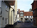
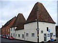
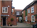
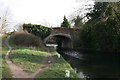
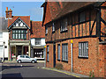
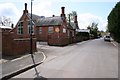
Photos of RG29 1LP
Area Information
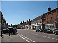
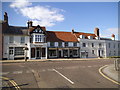
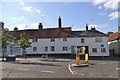
Living in RG29 1LP means residing within a compact, self-contained residential cluster defined by a specific postcode boundary. This area covers just 1.2 hectares and houses a population of 2,147 people. You will find that population density stands at 426 people per square kilometre, indicating a setting that is neither densely packed nor isolated. The location sits on the outskirts of Hampshire, offering a quiet domestic environment away from the immediate bustle of larger towns. Daily life here revolves around a small community where neighbours often know one another due to the limited geographic spread. The postcode serves as the precise identifier for this distinct housing pocket. You navigate the area in a car or on foot, as the small footprint means destinations are never far away. The environment is calm and residential by design. Residents enjoy a sense of space while remaining connected to the wider network of villages and towns that surround this designated zone.
- Area Type
- Postcode
- Area Size
- 1.2 hectares
- Population
- 2147
- Population Density
- 426 people/km²
The property market in RG29 1LP is characterised by stability and private ownership. With 77 percent of homes owned by residents, this postcode is squarely an owner-occupied area rather than a student villa or rental hub. The accommodation type is exclusively houses, meaning you will not find flats or maisonettes within this specific boundary. This housing stock typically appeals to families seeking traditional living arrangements with private gardens and outdoor space. Buyers looking at homes in RG29 1LP find an environment where chains are often shorter because owners are less likely to sell quickly in a rental market. The absence of rental flats suggests a lower concentration of transient households. You are purchasing a establishment within a neighbourhood where neighbours likely have deep local roots. The market dynamics reflect a desire for permanence and security over flexibility.
House Prices in RG29 1LP
Showing 22 properties
| Address | Type | Beds | Baths | Last Sale Price | Last Sale Date | |
|---|---|---|---|---|---|---|
| Rye Croft, 90-98 High Street, Odiham, RG29 1LP | Flat | - | - | £1,375,500 | Mar 2019 | |
| Living Accommodation, Martins Newsagents, 108 High Street, Odiham, Hook, RG29 1LP | Retail | - | - | - | - | |
| 1, Byways, 88 High Street, Odiham, Hook, RG29 1LP | Flat | 2 | - | - | - | |
| Hambridge Ltd, Barley Row, 90-98 High Street, Odiham, Hook, RG29 1LP | Flat | - | - | - | - | |
| Flat 1, 84 High Street, Odiham, Hook, RG29 1LP | Flat | - | - | - | - | |
| 4, Byways, 88 High Street, Odiham, Hook, RG29 1LP | Flat | - | - | - | - | |
| 3, Byways, 88 High Street, Odiham, Hook, RG29 1LP | Flat | - | - | - | - | |
| 12, Byways, 88 High Street, Odiham, Hook, RG29 1LP | Flat | - | - | - | - | |
| 11, Byways, 88 High Street, Odiham, Hook, RG29 1LP | Flat | - | - | - | - | |
| 86 High Street, Odiham, Hook, RG29 1LP | Flat | - | - | - | - |
Energy Efficiency in RG29 1LP
Your leisure and daily shopping needs are met by a small circle of amenities located within practical reach of RG29 1LP. Retail options include The Southern Co-operative Co, Tesco Hook, and Budgens Hook, giving you five key retail destinations to choose from. These shops provide essential groceries and household goods without requiring a long journey. Two airports lie nearby, including RAF Odiham and Lasham Airport, which adds a unique utility to the area even if you do not own a private plane. Four railway stations offer rapid access to the broader region, featuring Hook Railway Station, Winchfield Railway Station, and Fleet Railway Station. You can catch a train to catch a flight or reach London with reasonable ease. The combination of high street shopping and rail links defines the convenience of living here. Specific venue names like the Southern Co-operative anchor the local high street experience.
Amenities
Schools
Families living in RG29 1LP have access to two primary schools nearby that shape the educational landscape for children in the community. Buryfields Infant School serves the early years curriculum with an Ofsted rating of good. Mayhill Junior School continues the education for older children, also carrying a good Ofsted rating. The primary nature of both institutions means children in this area receive their foundational education close to home. The straightforward details of these schools provide clear information for parents considering moving. You do not need to look further afield for primary education options as these names represent the nearest provision. The consistent good ratings across both facilities offer reassurance regarding quality. The mix of an infant school and a junior school covers the entire primary phase. These specific names and ratings define the schooling experience for any family relocating to the postcode.
| Rank | School | Type | Entry gender | Ages |
|---|
Explore more schools in this area
Go to Schools tabDemographics
The community in RG29 1LP reflects a settled population with a median age of 47 years. Most residents fall into the adult age range between 30 and 64 years, suggesting the area attracts families and long-term occupants rather than students or retirees. Homeownership is a defining feature, with 77 percent of properties owned outright or with a mortgage. This high figure indicates stability, as the majority of households have stayed put rather than renting on short-term contracts. Houses form the predominant accommodation type throughout the housing stock. The predominant ethnic group is White, which aligns with the established character of many villages in this part of Hampshire. You will find a consistent community profile across the neighbourhood. The demographic data points to a mature area where families look to build roots. The concentration of adults in the middle working age supports a steady economy within the local sphere.
Household Size
Accommodation Type
Tenure
Ethnic Group
Religion
Household Composition
Age
Household Deprivation
NS-SEC
Explore more demographic insights in this area
Go to Demographics tabPlanning
Planning Constraints
- Flood RiskPremium
- Ramsar Wetland SitesPremium
- Area of Outstanding Natural BeautyPremium
- Protected Nature ReservePremium
- Protected WoodlandPremium