Area Overview for RG28 7FL
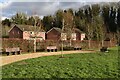
Photos of RG28 7FL


Area Information
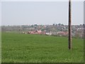
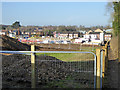
RG28 7FL represents a specific residential cluster defined by its compact footprint and established character. The postcode covers an area of 9,804 square metres, housing a population of 1,907 people. This density results in 1,027 people per square kilometre, creating a tight-knit environment rather than an expansive suburb. Residents here experience a grounded existence within a clearly bounded residential zone. The setting excludes large-scale commercial districts or major industrial zones, focusing instead on domestic living. This makes the location ideal for those seeking a contained neighbourhood experience without the sprawling distances of larger towns. Daily life revolves around immediate proximity to services and a close relationship with local infrastructure. You are part of a community where the boundaries between home and local amenities are distinct. The area does not attempt to mimic bustling city centres; instead, it offers a focused residential environment. Understanding the scale of 9,804 square metres helps you appreciate the limited but defined nature of your future surroundings. This postcode is not a broad district but a precise cluster where every square metre serves a residential purpose.
- Area Type
- Postcode
- Area Size
- 9804 m²
- Population
- 1907
- Population Density
- 1027 people/km²
The property market in RG28 7FL is characterised by a high percentage of owner-occupied properties. Current data shows 60% of the 1,907 residents are homeowners, indicating a market driven by existing residents rather than transient tenants. Accommodation types focus heavily on houses, suggesting the area was developed or selected for family-sized domestic units rather than apartments or studios. This housing stock appeals to buyers seeking traditional British homes. The concentration of home ownership creates a market where price fluctuations often reflect long-term equity growth. You are looking at an area where the majority of buyers have already completed the transition from renting to owning. This dynamic stabilises the market against sudden vacating rates common in rental-heavy districts. Potential buyers should expect to compete with owners who value stability. The mix of houses means you cannot assume the presence of high-density blocks or land for re-development. Every property in this 9,804 square metre cluster adheres to the house model. This structural consistency simplifies your search process as you know exactly what type of building you are viewing.
House Prices in RG28 7FL
Showing 9 properties
| Address | Type | Beds | Baths | Last Sale Price | Last Sale Date | |
|---|---|---|---|---|---|---|
| 15 Pipkin Gardens, Whitchurch, RG28 7FL | house | - | - | £395,000 | Jan 2022 | |
| 13 Pipkin Gardens, Whitchurch, RG28 7FL | house | - | - | £574,950 | Feb 2020 | |
| 11 Pipkin Gardens, Whitchurch, RG28 7FL | house | - | - | £289,500 | Sep 2018 | |
| 17 Pipkin Gardens, Whitchurch, RG28 7FL | Semi-detached | 1 | - | - | - | |
| 5 Pipkin Gardens, Whitchurch, RG28 7FL | Flat | - | - | - | - | |
| 1 Pipkin Gardens, Whitchurch, RG28 7FL | Bungalow | - | - | - | - | |
| 9 Pipkin Gardens, Whitchurch, RG28 7FL | house | - | - | - | - | |
| 3 Pipkin Gardens, Whitchurch, RG28 7FL | Flat | - | - | - | - | |
| 7 Pipkin Gardens, Whitchurch, RG28 7FL | Bungalow | - | - | - | - |
Energy Efficiency in RG28 7FL
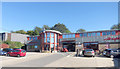
Living in RG28 7FL places you within walking or driving distance of five retail outlets including Co-op Whitchurch, Tesco Whitchurch, and Spar. These venues handle your daily grocery and convenience needs without requiring a trip to a distant town centre. Three railway stations serve the immediate vicinity, providing regular rail access through Whitchurch Railway Station, Overton Railway Station, and Micheldever Railway Station. This network integrates seamlessly with your retail visits, allowing you to combine shopping with commuting. The specific inclusion of Co-op and Tesco establishes a standard high-street shopping environment familiar to most residents. You have access to essential services without needing a vehicle for every small purchase. The proximity of Spar offers additional quick-stop options for those with less time. Retail choices are practical rather than luxurious, prioritising necessity over variety. You can complete your weekly shop at Tesco or grab essentials at Co-op with ease. The railway connections ensure you maintain freedom of movement beyond the local cluster. This balance of local retail and rail transport defines the practical lifestyle here.
Amenities
Schools
| Rank | School | Type | Entry gender | Ages |
|---|
Explore more schools in this area
Go to Schools tabDemographics
The community in RG28 7FL reflects a stable, mature household composition with 60% of residents owning their homes. Accommodation types are predominantly houses, supporting families and established individuals. The median age stands at 47 years, signalling that the most common age range among residents is adults aged between 30 and 64 years. This demographic profile indicates a population that has secured their homes and is focused on long-term living. You are likely to meet neighbours who have remained in the area for significant periods. The predominant ethnic group is White, which is reflected in the general community composition. With a population of 1,907 people, the area maintains a consistent character without rapid demographic shifts. The high level of home ownership suggests strong local investment and stability. Residents are generally past the initial renting phase, prioritising ownership within the cluster. The age distribution means the area caters to working professionals and those approaching retirement rather than young families. This creates a settled atmosphere where community bonds tend to form over time. You can expect a neighbourhood defined by longevity and home stability.
Household Size
Accommodation Type
Tenure
Ethnic Group
Religion
Household Composition
Age
Household Deprivation
NS-SEC
Explore more demographic insights in this area
Go to Demographics tabPlanning
Planning Constraints
- Flood RiskPremium
- Ramsar Wetland SitesPremium
- Area of Outstanding Natural BeautyPremium
- Protected Nature ReservePremium
- Protected WoodlandPremium