Area Overview for RG27 9FR
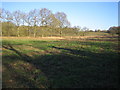
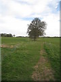
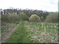
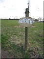
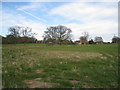
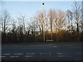
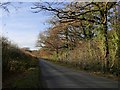
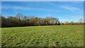
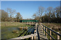
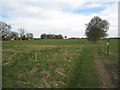
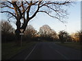
Photos of RG27 9FR

Area Information
Living in RG27 9FR involves residing within a specific postcode cluster that spans just two hectares. This small residential area accommodates 2,528 people, creating a closely knit environment where neighbours are likely situations. The compact size means daily life often revolves around than a immediate neighbourhood rather than distant city centres. Residents here enjoy the distinct character of a hamlet integrated into the wider Hook and Nursling locale. The area sits roughly 10 miles west of London, positioning it as a commuter settlement with direct links to Hampshire and Surrey. Your morning routine will likely involve quick drives or a short walk to local services rather than long commutes across the county. The housing stock consists entirely of houses, distinguishing this patch from the terraced streets found in larger urban towns.
- Area Type
- Postcode
- Area Size
- 2.0 hectares
- Population
- 2528
- Population Density
- 269 people/km²
The property market in RG27 9FR operates as a predominantly owner-occupied sector. The data confirms that 80% of households hold their homes outright or through mortgages, pointing away from a high-volume student or transient rental market. This high ownership rate typically stabilises prices and reduces the turnover seen in student lambeth areas. The accommodation type is exclusively houses, which aligns with the demographic shift towards older families and empty nesters seeking space. You will find a range of house styles and eras within this two-hectare perimeter, though the lack of flats limits choices for those seeking smaller properties. Buyers entering this market are likely purchasing for permanent residence rather than short-term rental yields. The limited size of the area, covering only two hectares, means supply is constrained, often driving competition for specific plots suitable for family life.
House Prices in RG27 9FR
Showing 10 properties
| Address | Type | Beds | Baths | Last Sale Price | Last Sale Date | |
|---|---|---|---|---|---|---|
| 6 Barker Crescent, Hook, RG27 9FR | Detached | 4 | 2 | £620,000 | Dec 2022 | |
| 10 Barker Crescent, Hook, RG27 9FR | house | - | - | £760,000 | Mar 2021 | |
| 9 Barker Crescent, Hook, RG27 9FR | house | - | - | £699,000 | Mar 2021 | |
| 5 Barker Crescent, Hook, RG27 9FR | Detached | 3 | 2 | £451,000 | Mar 2021 | |
| 8 Barker Crescent, Hook, RG27 9FR | house | - | - | £685,000 | Dec 2020 | |
| 7 Barker Crescent, Hook, RG27 9FR | house | - | - | £750,000 | Dec 2020 | |
| 2 Barker Crescent, Hook, RG27 9FR | house | - | - | £650,000 | Feb 2020 | |
| 4 Barker Crescent, Hook, RG27 9FR | house | - | - | £750,000 | Jan 2020 | |
| 3 Barker Crescent, Hook, RG27 9FR | house | - | - | £669,000 | Jan 2020 | |
| 1 Barker Crescent, Hook, RG27 9FR | house | - | - | £600,000 | Dec 2019 |
Energy Efficiency in RG27 9FR
Daily life in RG27 9FR benefits from a cluster of retail and transport amenities within practical reach. You have access to five retail locations including Sainsburys Hook, Spar, and Budgens Hook, ensuring you do not need to travel far for groceries or daily essentials. The area's proximity to railways is a key convenience, with Hook Railway Station, Winchfield Railway Station, and Bramley Railway Station all listed as nearby options. This network facilitates easy travel if you work elsewhere or wish to visit friends in other counties. For aviation enthusiasts, Blackbushe Airport and RAF Odiham are nearby, though these serve specific purposes rather than general leisure. The concentration of five retail outlets means you can combine shopping for everyday items. This arrangement reduces the need for long shopping trips or heavy reliance on large supermarkets miles away.
Amenities
Schools
Parents considering RG27 9FR have access to specific educational facilities within a practical commuting distance. Whitewater Church of England Primary School serves the primary education needs of younger children in the vicinity. This institution holds a Good rating from Ofsted, providing reassurance for families seeking a standard of education above basic competency. As this is a housing-only area with a median age of 47, there are no secondary schools listed directly within the immediate data for this postcode. Families with older children may need to look further afield for comprehensive or grammar school options. The presence of a single primary school with a positive rating suggests a focused local provision. While this works for early education, residents of RG27 9FR should investigate school catchment areas carefully for secondary placements.
| Rank | School | Type | Entry gender | Ages |
|---|
Explore more schools in this area
Go to Schools tabDemographics
The community in RG27 9FR is defined by a mature household profile. The median age here stands at 47 years, with the most common age range falling between 30 and 64 years. This demographic suggests a settlement dominated by families and established professionals rather than young singles or retirees. A significant distinction for this location is the high level of stability within the homes. Eighty per cent of households own their properties, indicating that investing in a home here is typical for the local population rather than a rental arrangement. White residents form the predominant ethnic group, reflecting a consistent cultural fabric that has evolved over decades. The accommodation type remains strictly houses, meaning you can expect detached, semi-detached, or bungalows rather than flats or maisonettes. These factors combine to create an area where long-term settlement is the norm.
Household Size
Accommodation Type
Tenure
Ethnic Group
Religion
Household Composition
Age
Household Deprivation
NS-SEC
Explore more demographic insights in this area
Go to Demographics tabPlanning
Planning Constraints
- Flood RiskPremium
- Ramsar Wetland SitesPremium
- Area of Outstanding Natural BeautyPremium
- Protected Nature ReservePremium
- Protected WoodlandPremium