Area Overview for RG27 9BH
Photos of RG27 9BH
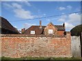
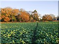
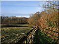
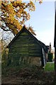
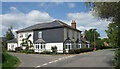
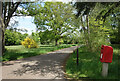
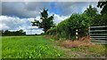
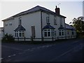
21 photos from this area
Area Information
Key information about the RG27 9BH including its size, population, and administrative classification.
- Area Type
- Postcode
- Area Size
- 88.0 hectares
- Population
- 1242
- Population Density
- 39 people/km²
House Prices in RG27 9BH
15
Properties
£637,500
Average Sold Price
£164,500
Lowest Price
£1,270,000
Highest Price
Showing 15 properties
| Address | Type | Beds | Baths | Last Sale Price | Last Sale Date | |
|---|---|---|---|---|---|---|
| 4 Lyde Green, Rotherwick, Hook, RG27 9BH | Terraced | - | - | £605,000 | Mar 2024 | |
| 1 Lyde Green, Rotherwick, Hook, RG27 9BH | Detached | 4 | 2 | £834,000 | May 2019 | |
| 3 Lyde Green, Rotherwick, Hook, RG27 9BH | Terraced | 3 | 1 | £391,500 | Aug 2018 | |
| 5 Lyde Green, Rotherwick, Hook, RG27 9BH | Terraced | 2 | 1 | £455,000 | Oct 2017 | |
| 9 Lyde Green, Rotherwick, Hook, RG27 9BH | Detached | 6 | 5 | £1,055,000 | May 2015 | |
| Bullpen Cottage, Frog Lane, Lyde Green, Rotherwick, RG27 9BH | house | - | - | £350,000 | Mar 2013 | |
| The Old Fox, Lyde Green, Rotherwick, Hook, RG27 9BH | Detached | 5 | - | £815,000 | Sep 2010 | |
| 6 Lyde Green, Rotherwick, Hook, RG27 9BH | Detached | - | - | £435,000 | Jun 2006 | |
| Poplars Farm, Frog Lane, Lyde Green, Rotherwick, RG27 9BH | house | - | - | £1,270,000 | Apr 2002 | |
| West House, Lyde Green, Rotherwick, Hook, RG27 9BH | house | - | - | £164,500 | Mar 1997 |
Page 1 of 2
Energy Efficiency in RG27 9BH
Amenities
Schools
| Rank | School | Type | Entry gender | Ages |
|---|
Explore more schools in this area
Go to Schools tabDemographics
Household Size
Two person
most common
Accommodation Type
Houses
most common
Tenure
72
majority
Ethnic Group
White
most common
Religion
N/A
most common
Household Composition
N/A
most common
Age
47
median
Adults (30-64 years)
most common
Household Deprivation
N/A
with no deprivation
NS-SEC
48
in Lower managerial occupations
Explore more demographic insights in this area
Go to Demographics tabPlanning
Planning Constraints
- Flood RiskPremium
- Ramsar Wetland SitesPremium
- Area of Outstanding Natural BeautyPremium
- Protected Nature ReservePremium
- Protected WoodlandPremium