Area Overview for RG27 9BD
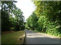
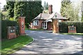
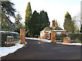
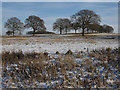
Photos of RG27 9BD
Area Information
Living in RG27 9BD offers a defined residential experience within a specific postcode cluster of just 5.6 hectares. You are entering a tightly knit environment where 2,528 residents call this small area home. The population density stands at 269 people per square kilometre, creating a neighbourhood that feels established yet contained. This postcode represents a distinct residential unit where daily life revolves around local familiarity and proximity. You will find that the area is not sprawling but rather concentrated, which often fosters a strong sense of community among neighbours who share the same streets and amenities. The mix of residents supports a stable local economy and vibrant local services. Whether you visit by foot or car, the scale of RG27 9BD ensures that you can navigate the local landscape efficiently. The area is situated in England where property search platforms help buyers understand these micro-markets. Homes in this specific postcode offer a clear picture of what modern family living looks like in this part of the country. You can expect a setting where the boundaries of your immediate surroundings are clearly understood by both residents and visitors alike.
- Area Type
- Postcode
- Area Size
- 5.6 hectares
- Population
- 2528
- Population Density
- 269 people/km²
When you look at the property market in RG27 9BD, two facts immediately define the inventory. The local stock consists almost entirely of houses. This means you will not find an apartment complex or a block of flats within this specific postcode. Furthermore, 80% of these homes are owner-occupied. This statistic reveals a market where residents have purchased their properties, likely over an extended period. Such a high percentage of owner-occupied homes creates a stable environment for sellers and buyers alike. You are looking at a residential zone free from the volatility often found in high-rental density areas. The distinction between houses and other property types is absolute here, catering to those seeking standalone or semi-detached living. For someone seeking a home, this data suggests a straightforward search for traditional housing options. The lack of rental data confirms that you are not competing against a student economy or temporary workers. Buyers here are local families or individuals who have chosen to invest in the area rather than rent.
House Prices in RG27 9BD
Showing 4 properties
| Address | Type | Beds | Baths | Last Sale Price | Last Sale Date | |
|---|---|---|---|---|---|---|
| 18 The Street, Rotherwick, Hook, RG27 9BD | house | 2 | 1 | £315,000 | May 2005 | |
| High View, The Street, Rotherwick, Hook, RG27 9BD | Terraced | - | - | £300,000 | Dec 2001 | |
| Hartford House, The Street, Rotherwick, Hook, RG27 9BD | Detached | - | - | - | - | |
| Post Horn Cottage, 15-16 The Street, Rotherwick, Hook, RG27 9BD | house | - | - | - | - |
Energy Efficiency in RG27 9BD
Daily life in RG27 9BD benefits from a practical range of amenities within easy reach. You have access to five retail outlets, including Budgens Hook, Spar, and Sainsburys Hook. These shops provide the essentials for weekly grocery runs and spontaneous purchases. For train commuting, you are close to five railway stations, with Hook Railway Station, Winchfield Railway Station, and Bramley Railway Station being notable locations. This rail network integration simplifies travel to Greater London and other regional hubs. Air travel options are also nearby, with RAF Odiham and Blackbushe Airport located within a short drive. This combination of retail, rail, and aviation access creates a convenient lifestyle hub. You do not need to travel far for basic services, yet you retain quick access to national networks. The presence of these specific venues means that a day trip or a quick stopover is manageable. Your proximity to these facilities ensures that convenience remains a priority without sacrificing the quiet of the residential area.
Amenities
Schools
For families residing in RG27 9BD, education is addressed by immediate local provision. The nearest school is Whitewater Church of England Primary School. This institution provides education for the children of families within the postcode and its immediate vicinity. The school holds an Ofsted rating of good, which indicates competent teaching standards and a reliable educational environment. As a Church of England primary school, it caters to younger pupils before they move on to secondary education elsewhere. This mix of school types reflects the needs of the local age demographic, which skew heavily towards adults. There are no secondary schools listed directly in this immediate cluster, meaning older children must travel to nearby towns for their GCSEs and A-levels. The presence of a single primary school with a good rating provides a clear baseline for those prioritising early education. Parents can rely on named institutions rather than temporary or unranked provision. This specific educational option supports the family-led demographic identified in other sections of the local data.
| Rank | School | Type | Entry gender | Ages |
|---|
Explore more schools in this area
Go to Schools tabDemographics
The community in RG27 9BD is characterised by stability and a mature age profile. The median age of 47 indicates a population where adults dominate the scene. Specifically, the most common age range consists of adults between 30 and 64 years. This demographic spread suggests households are likely in various stages of family life or retirement rather than young professionals just starting out. Home ownership represents a major pillar of this community, with 80% of dwellings occupied by their owners. This high rate implies long-term residency and investment in local property values rather than a transient rental market. You will encounter a predominantly white ethnic group, reflecting the typical demographic makeup of established English neighbourhoods. The primary accommodation type is houses, which aligns with the older age profile and home ownership figures. There are no large blocks of flats or high-density blocks here; instead, you find traditional housing stock. This demographic data paints a picture of a settled population where families and retirees have put down roots.
Household Size
Accommodation Type
Tenure
Ethnic Group
Religion
Household Composition
Age
Household Deprivation
NS-SEC
Explore more demographic insights in this area
Go to Demographics tabPlanning
Planning Constraints
- Flood RiskPremium
- Ramsar Wetland SitesPremium
- Area of Outstanding Natural BeautyPremium
- Protected Nature ReservePremium
- Protected WoodlandPremium