Area Overview for RG27 9AJ
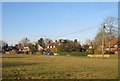
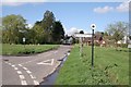
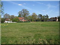
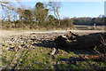
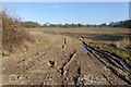
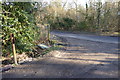
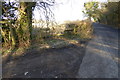
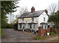
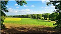
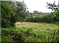
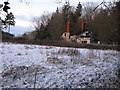
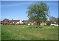
Photos of RG27 9AJ
Area Information
Living in the RG27 9AJ postcode reveals a small, self-contained residential cluster situated in Hook, Hampshire. This specific area covers 37.2 hectares and supports a population of 1,871. With a population density of 107 people per square kilometre, the locality offers a low-density environment where homes are spread across the landscape rather than packed into a tight urban core. The community feels established and settled, characteristic of a housing cluster that has evolved naturally over time. Residents benefit from being in a defined area where local knowledge is easily shared among neighbours. The mix of family homes and retirees creates a stable social dynamic that defines daily life here. People seeking quiet living away from the bustle of larger towns will find this postcode attractive. The modest size of the area means you will spend more time in your immediate surroundings than commuting through congested city centres. You can walk to nearby doorstep shops or cycle to the main high street for larger retailers. The residential nature of RG27 9AJ provides a calm backdrop for family life or retirement. While the area is small, its location places it within practical reach of Stratford-upon-Avon and Oxford for work or leisure. This postcode represents a practical choice for those who prioritise space and tranquility without sacrificing access to regional transport links.
- Area Type
- Postcode
- Area Size
- 37.2 hectares
- Population
- 1871
- Population Density
- 107 people/km²
The property market in RG27 9AJ is defined by a strong leaning towards owner-occupation. A specific 81% home ownership rate indicates that the vast majority of residents have purchased their dwellings rather than renting them from a letting agent. This statistic contrasts sharply with major university towns or cities where private renting is the norm. Consequently, the housing stock is dominated by houses, reflecting the preference of locals to settle in detached, semi-detached, or terraced properties. For buyers looking at homes in this postcode, the market presents a distinct character from more transient urban centres. Properties here are often passed down through families or bought after being lived in for decades. The nature of the homes as houses rather than flats suggests that you are seeking ground-level living with outdoor space. This structure supports the high ownership rate, as people buy to build equity and create a legacy for their families. While no specific price data is included in this report, the ownership model implies a market driven by traditional family economics. Anyone considering this area should expect to engage with local knowledge regarding land values and property history, rather than dealing with quick-turnaround corporate landlords.
House Prices in RG27 9AJ
Showing 5 properties
| Address | Type | Beds | Baths | Last Sale Price | Last Sale Date | |
|---|---|---|---|---|---|---|
| Newnham Lodge, Tylney Lane, Newnham, RG27 9AJ | Detached | 4 | 2 | £1,171,500 | Sep 2024 | |
| Woodside, Tylney Lane, Newnham, RG27 9AJ | Detached | 4 | 3 | £1,150,000 | Mar 2023 | |
| Newnham Edge, Tylney Lane, Newnham, RG27 9AJ | house | - | - | £1,605,000 | Nov 2017 | |
| Bridleway, Tylney Lane, Newnham, RG27 9AJ | house | - | - | £885,000 | Jul 2016 | |
| The Acorns, Tylney Lane, Newnham, RG27 9AJ | house | - | - | - | - |
Energy Efficiency in RG27 9AJ
Residents of RG27 9AJ enjoy amenities within practical reach that support a self-sufficient local lifestyle. The High Street in Hook hosts several key retail outlets, including a Tesco, a Spar, and Budgens. These three main stores provide everything from groceries to household essentials, ensuring you can attend to your shopping needs without travelling far. There are five notable retail venues in total, creating a convenient local high street that avoids the congestion of larger city centres. Transport options extend beyond local shops to include four main railway stations: Hook, Winchfield, Bramley, and others in the vicinity. Hook Railway Station offers a direct link to broader London rail networks. For those near the military base, RAF Odiham is situated nearby, though this serves primarily as a major employer rather than leisure transport. The area does not rely on public parks or schools located directly within the immediate 37.2 hectares of the postcode itself. Instead, residents travel short distances to reach these facilities. This setup supports a balanced life where daily shopping is a five-minute drive, but larger leisure or educational activities require a short journey into the wider town.
Amenities
Schools
| Rank | School | Type | Entry gender | Ages |
|---|
Explore more schools in this area
Go to Schools tabDemographics
The community within RG27 9AJ reflects a mature demographic profile. The median age stands at 47, indicating that the neighbourhood is populated predominantly by adults aged between 30 and 64 years. This age range suggests a stability often found in established residential zones rather than student quarters or transient rental schemes. The area is slow changing, with 81% of residents owning their homes outright or through a mortgage. This high rate of ownership points to long-term occupancy and a community invested in the local area. Accommodation types consist primarily of houses, which aligns with the demographic shift away from high-density living. The predominant ethnic group is White, mirroring the broader patterns of West Essex and surrounding counties. The social fabric remains relatively homogeneous, centred around long-standing connections among property owners. This profile often appeals to retirees, families with school-age children, and couples looking for a permanent home in the countryside. The lack of significant student populations means public services and local amenities cater to a general family and adult audience rather than young professionals seeking a short-term lease.
Household Size
Accommodation Type
Tenure
Ethnic Group
Religion
Household Composition
Age
Household Deprivation
NS-SEC
Explore more demographic insights in this area
Go to Demographics tabPlanning
Planning Constraints
- Flood RiskPremium
- Ramsar Wetland SitesPremium
- Area of Outstanding Natural BeautyPremium
- Protected Nature ReservePremium
- Protected WoodlandPremium