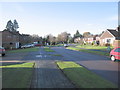
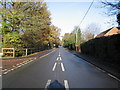
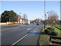
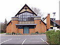
Area Overview for RG27 8SA
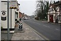
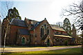
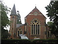
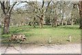
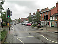
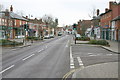
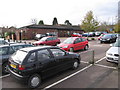
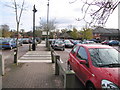
Photos of RG27 8SA
Area Information
RG27 8SA represents a small, defined residential cluster within the wider RG27 postcode area of Hampshire. You are looking at a specific set of properties covering just 9,641 square metres. Despite its compact size, this locality supports a community of 1,659 people, resulting in a population density of 486 people per square kilometre. The area functions as a self-contained neighbourhood rather than a sprawling district, typical of postcodes that denote specific streets or road sections. Living in RG27 8SA means prioritising a contained environment where daily services are within practical reach. The density suggests a relationship between neighbours that is closer than in vast, open developments but not as intense as high-rise urban living. This postcode falls within England, placing it firmly in the southern English property market. Residents here balance the intimacy of a small cluster with the broader access provided by surrounding infrastructure. You get a distinct postcode identity that defines your local boundaries while staying connected to the wider town and county facilities.
- Area Type
- Postcode
- Area Size
- 9641 m²
- Population
- 1659
- Population Density
- 486 people/km²
Homes in RG27 8SA are overwhelmingly part of the buy-to-live market rather than a rental landscape. With 91 per cent of residents owning their properties, the area functions as a strong owner-occupied zone. This high ownership rate creates stability in the local housing stock and reduces the volume of short-term letting activity. The accommodation type is houses, which implies that terraced blocks or high flats are absent from this specific postcode. Buyers looking at RG27 8SA should expect to find detached, semi-detached, or stand-alone family homes rather than urban flats. This housing style supports the established demographic of mostly adults aged 30 to 64 who have likely moved here for families or later-life living. The size of the area, covering only 9,641 square metres, means the physical footprint of housing is concentrated. There is little room for large commercial developments to encroach upon the residential nature. You are viewing a market driven by existing owners who either remained or sold to other permanent residents. This environment typically carries a reputation for lower turn-over rates compared to urban commuter belts.
House Prices in RG27 8SA
Showing 9 properties
| Address | Type | Beds | Baths | Last Sale Price | Last Sale Date | |
|---|---|---|---|---|---|---|
| Winslade, New Road, Hartley Wintney, Hook, RG27 8SA | Detached | 3 | 2 | £830,000 | Jan 2021 | |
| Wyedene, New Road, Hartley Wintney, Hook, RG27 8SA | Detached | 3 | 1 | £681,000 | Nov 2015 | |
| Thackhams End, New Road, Hartley Wintney, Hook, RG27 8SA | Detached | - | - | £435,000 | Nov 2006 | |
| Fairfield, New Road, Hartley Wintney, Hook, RG27 8SA | Detached | - | - | £395,000 | Oct 2006 | |
| Oak Common Cottage, New Road, Hartley Wintney, Hook, RG27 8SA | house | - | - | £375,000 | May 2006 | |
| Berryhorn, New Road, Hartley Wintney, Hook, RG27 8SA | Detached | - | - | £283,000 | Aug 1999 | |
| 5 New Road, Hartley Wintney, Hook, RG27 8SA | house | - | - | - | - | |
| Rusper, New Road, Hartley Wintney, Hook, RG27 8SA | Detached | - | - | - | - | |
| Newlands, New Road, Hartley Wintney, Hook, RG27 8SA | Detached | - | - | - | - |
Energy Efficiency in RG27 8SA
Daily life in RG27 8SA benefits from immediate access to major retail outlets and transport hubs. Residents can shop at Tesco Hartley and the Waitrose store located at Winchfield, both designated as key nearby amenities. These retail points are within practical walking or short driving distance, ensuring you do not need to travel far for groceries or everyday essentials. Transport connectivity is supported by five notable stations, including Winchfield Railway Station, Hook Railway Station, and Fleet Railway Station. These rail links provide straightforward connections to wider Hampshire and London networks. For those requiring aviation access, three airports lie nearby, including Blackbushe Airport, RAF Odiham, and Farnborough Airport. This mix of rail and air options makes the area suitable for commuters needing flexibility. The presence of specific named venues like Waitrose and Tesco Hartley grounds the abstract concept of "local amenities" in real, usable destinations. You will find that the concentration of these facilities supports a practical, low-stress routine. Living in this postcode means your shopping and travel needs are addressed by established, recognised infrastructure.
Amenities
Schools
| Rank | School | Type | Entry gender | Ages |
|---|
Explore more schools in this area
Go to Schools tabDemographics
The community within RG27 8SA reflects the characteristics of more settled households rather than transient urban dwellers. The median age for residents here is 47 years, indicating a maturity that often correlates with family stability. Most commonly, occupants fall into the adult age range of 30 to 64 years. This demographic profile suggests the area attracts young professionals and families who have already established careers or are raising children. Home ownership stands at an impressive 91 per cent for these residents. This high figure signals a permanent resident base rather than a private rental market. The accommodation type is predominantly houses, meaning single-family dwellings form the core of the stock. Regarding diversity, the predominant ethnic group is White, which aligns with the broader demographic trends of many rural and suburban Hampshire settlements. The population mix creates a homogenous social fabric where long-term residents likely know one another through time rather than through transient social networks. This stability supports a quiet, predictable environment for those seeking a home.
Household Size
Accommodation Type
Tenure
Ethnic Group
Religion
Household Composition
Age
Household Deprivation
NS-SEC
Explore more demographic insights in this area
Go to Demographics tabPlanning
Planning Constraints
- Flood RiskPremium
- Ramsar Wetland SitesPremium
- Area of Outstanding Natural BeautyPremium
- Protected Nature ReservePremium
- Protected WoodlandPremium