Area Overview for RG27 8PW
Photos of RG27 8PW
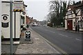
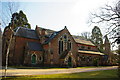
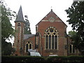
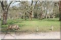
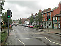
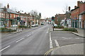
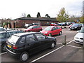
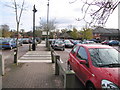
100 photos from this area
Area Information
Key information about the RG27 8PW including its size, population, and administrative classification.
- Area Type
- Postcode
- Area Size
- 3.7 hectares
- Population
- 2130
- Population Density
- 130 people/km²
House Prices in RG27 8PW
13
Properties
£1,104,300
Average Sold Price
£147,000
Lowest Price
£3,750,000
Highest Price
Showing 13 properties
| Address | Type | Beds | Baths | Last Sale Price | Last Sale Date | |
|---|---|---|---|---|---|---|
| Barefoot House, Mount Pleasant, Hartley Wintney, Hook, RG27 8PW | house | 4 | 2 | £1,200,000 | Oct 2023 | |
| Cherry Hinton, Mount Pleasant, Hartley Wintney, Hook, RG27 8PW | house | - | - | £1,200,000 | Jan 2023 | |
| Highfield, Mount Pleasant, Hartley Wintney, Hook, RG27 8PW | house | - | - | £1,200,000 | Oct 2022 | |
| Flat, Grey House, Mount Pleasant, Hartley Wintney, Hook, RG27 8PW | Flat | - | - | £3,750,000 | Sep 2022 | |
| Lyde Cottage, Mount Pleasant, Hartley Wintney, Hook, RG27 8PW | Bungalow | 3 | 2 | £950,000 | Oct 2019 | |
| The Turret, Mount Pleasant, Hartley Wintney, Hook, RG27 8PW | Detached | 4 | - | £1,070,000 | Jul 2014 | |
| Compton Cottage, Mount Pleasant, Hartley Wintney, Hook, RG27 8PW | Detached | 5 | - | £946,000 | Sep 2013 | |
| The Anchorage, Mount Pleasant, Hartley Wintney, Hook, RG27 8PW | Detached | - | - | £147,000 | Aug 2006 | |
| Bergholt, Mount Pleasant, Hartley Wintney, Hook, RG27 8PW | Detached | - | - | £220,000 | Mar 1999 | |
| Carbery, Mount Pleasant, Hartley Wintney, Hook, RG27 8PW | Detached | 4 | 2 | £360,000 | Jan 1999 |
Page 1 of 2
Energy Efficiency in RG27 8PW
Amenities
Schools
| Rank | School | Type | Entry gender | Ages |
|---|
Explore more schools in this area
Go to Schools tabDemographics
Household Size
One person
most common
Accommodation Type
Houses
most common
Tenure
66
majority
Ethnic Group
White
most common
Religion
N/A
most common
Household Composition
N/A
most common
Age
47
median
Adults (30-64 years)
most common
Household Deprivation
N/A
with no deprivation
NS-SEC
46
in Lower managerial occupations
Explore more demographic insights in this area
Go to Demographics tabPlanning
Planning Constraints
- Flood RiskPremium
- Ramsar Wetland SitesPremium
- Area of Outstanding Natural BeautyPremium
- Protected Nature ReservePremium
- Protected WoodlandPremium