Area Overview for RG27 8PD
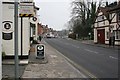
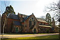
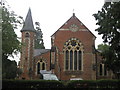
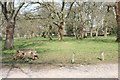
Photos of RG27 8PD
Area Information
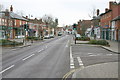
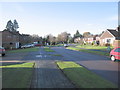
Living in RG27 8PD involves residing in a tightly knit residential cluster defined by its specific postcode. This area occupies 8,647 square metres and accommodates a population of 2,130 people, resulting in a low density of 130 people per square kilometre. The location functions as a quiet residential pocket, offering a distinct separation from the busier thoroughfares surrounding it. Residents here experience a calm environment where daily life moves at a measured pace, free from the congestion often found in larger settlements. The small physical footprint means that the community is compact, allowing neighbours to interact frequently while maintaining individual privacy within their properties. This postcode serves as a gateway to broader towns and rail connections, yet it retains a sense of seclusion. Homebuyers choosing RG27 8PD prioritize a low-density lifestyle over urban convenience. The space available per resident is significantly higher than the national average, providing ample room for gardens and outdoor activities. This balance of accessibility and isolation defines the everyday experience for everyone from retiring couples to young families seeking peace.
- Area Type
- Postcode
- Area Size
- 8647 m²
- Population
- 2130
- Population Density
- 130 people/km²
RG27 8PD operates as a squarely owner-occupied market with 66% of homes held by their owners. This statistic confirms that developers and landlords do not dominate the local housing stock. Instead, the area consists of established households who have grown roots in the community over many years. The accommodation type is exclusively houses, meaning buyers searching for flats or converted period properties will need to look elsewhere. This house-centric market caters primarily to families and retirees who value space and traditional living arrangements. Potential purchasers should anticipate competition from current owners looking to move up or down the ladder. The lack of rental housing suggests a limited supply for investors targeting the buy-to-let sector within this specific cluster. Buyers entering the market here compete for a finite number of family-sized properties. The nature of the housing stock implies that new builds are unlikely to change the character of the street in the near future. Homebuyers must be prepared for values driven by the scarcity of detached or semi-detached properties in such a small area.
House Prices in RG27 8PD
Showing 15 properties
| Address | Type | Beds | Baths | Last Sale Price | Last Sale Date | |
|---|---|---|---|---|---|---|
| 5, Becketts, High Street, Hartley Wintney, Hook, RG27 8PD | Flat | 1 | 1 | £195,950 | Jun 2018 | |
| Hartley Green House, High Street, Hartley Wintney, Hook, RG27 8PD | Detached | - | - | £1,120,000 | Mar 2007 | |
| 16, Becketts, High Street, Hartley Wintney, Hook, RG27 8PD | Flat | - | - | - | - | |
| 12, Becketts, High Street, Hartley Wintney, Hook, RG27 8PD | Flat | - | - | - | - | |
| 4, Becketts, High Street, Hartley Wintney, Hook, RG27 8PD | Maisonette | - | - | - | - | |
| 6, Becketts, High Street, Hartley Wintney, Hook, RG27 8PD | Flat | - | - | - | - | |
| 17, Becketts, High Street, Hartley Wintney, Hook, RG27 8PD | Flat | - | - | - | - | |
| 18, Becketts, High Street, Hartley Wintney, Hook, RG27 8PD | Flat | - | - | - | - | |
| 9, Becketts, High Street, Hartley Wintney, Hook, RG27 8PD | Flat | - | - | - | - | |
| 15, Becketts, High Street, Hartley Wintney, Hook, RG27 8PD | Flat | - | - | - | - |
Energy Efficiency in RG27 8PD
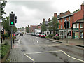
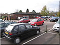
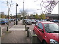
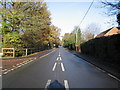
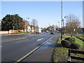
Daily life in RG27 8PD benefits from a convenient radius of amenities despite the rural character of the postcode. Residents have access to five retail locations within easy reach, including a Tesco Hartley and two branches of Waitrose. These supermarkets ensure that fresh food and daily essentials are available without a long journey into larger towns. For travel needs, there are five rail connections linking directly to major hubs like London Waterloo. This network includes Winchfield, Hook, and Fleet Railway Stations, facilitating easy commutes for workers. Aviation enthusiasts or business travellers can utilise three airports nearby, namely Blackbushe Airport, RAF Odiham, and Farnborough Airport. While these are major transport nodes, they primarily serve commercial and private aviation rather than scheduled passenger flights. The combination of strong retail presence and robust rail links creates a balanced lifestyle. Shoppers do not need to travel far for groceries, while commuters enjoy reliable train services. This separation of daily shopping and weekly commuting allows residents to maintain a peaceful home environment while accessing city opportunities.
Amenities
Schools
Families considering homes in RG27 8PD have access to specific educational options within practical reach. The area serves Oakwood Infant School, which holds a Good rating from Ofsted for primary education. Parents prioritising state education in the vicinity will find this school meets government standards for teaching quality and behavioural expectations. For families seeking private education, Grey House Preparatory School is available as an independent alternative nearby. The presence of both a state primary and an independent preparatory school provides a clear分流 for different educational philosophies. However, the data does not list secondary schools immediately adjacent to this postcode. Children aged 11 and above would require travel to schools outside the immediate cluster or to nearby towns. The mix of school types supports families with children from infancy through to early adolescence. Parents should verify catchment areas for Oakwood Infant School to ensure eligibility for their specific address. The availability of a highly rated state school and a private option indicates good planning for younger dependents.
| Rank | School | Type | Entry gender | Ages |
|---|
Explore more schools in this area
Go to Schools tabDemographics
The community within RG27 8PD is stability-focused, reflected in a median age of 47 years. This demographic profile places the mainstream of the population within the 30 to 64-year age bracket, suggesting a workforce and families settled in mid-life stages. A significant majority of the population, standing at 66%, owns their homes outright or with a mortgage. This high home-ownership rate indicates that investment in the neighbourhood is long-term and that most residents view their property as a permanent anchor rather than a temporary asset. Socially, the area is predominantly white, mirroring the broader patterns of the region. The settlement consists mainly of houses, which aligns with the preference of the existing older demographic. There are no rental towers or high-rise apartments visible in this postcode; instead, residents live in traditional dwellings with established gardens. The age profile suggests a neighbourhood where empty nesters and families with school-aged children coexist in a shared cultural framework. This consistency in resident type fosters a predictable and stable community atmosphere.
Household Size
Accommodation Type
Tenure
Ethnic Group
Religion
Household Composition
Age
Household Deprivation
NS-SEC
Explore more demographic insights in this area
Go to Demographics tabPlanning
Planning Constraints
- Flood RiskPremium
- Ramsar Wetland SitesPremium
- Area of Outstanding Natural BeautyPremium
- Protected Nature ReservePremium
- Protected WoodlandPremium