Area Overview for RG27 8EX
Photos of RG27 8EX
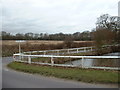
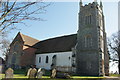
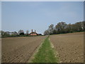


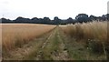
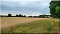
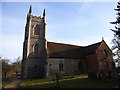
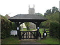
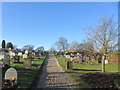
23 photos from this area
Area Information
Key information about the RG27 8EX including its size, population, and administrative classification.
- Area Type
- Postcode
- Area Size
- 2.2 hectares
- Population
- 2133
- Population Density
- 1092 people/km²
House Prices in RG27 8EX
37
Properties
£266,711
Average Sold Price
£50,000
Lowest Price
£535,000
Highest Price
Showing 37 properties
| Address | Type | Beds | Baths | Last Sale Price | Last Sale Date | |
|---|---|---|---|---|---|---|
| 28 Priory Lane, Hartley Wintney, Hook, RG27 8EX | Bungalow | - | - | £450,000 | Aug 2024 | |
| 1 Priory Lane, Hartley Wintney, Hook, RG27 8EX | house | - | - | £482,500 | Jun 2021 | |
| 35 Priory Lane, Hartley Wintney, Hook, RG27 8EX | house | - | - | £535,000 | Feb 2021 | |
| 30 Priory Lane, Hartley Wintney, Hook, RG27 8EX | Semi-detached | 3 | 1 | £340,000 | Aug 2019 | |
| 24 Priory Lane, Hartley Wintney, Hook, RG27 8EX | Maisonette | 2 | 1 | £224,950 | Sep 2016 | |
| 8 Priory Lane, Hartley Wintney, Hook, RG27 8EX | Semi-detached | 3 | - | £382,500 | Oct 2013 | |
| 7 Priory Lane, Hartley Wintney, Hook, RG27 8EX | Semi-detached | 4 | 2 | £405,000 | May 2007 | |
| 36 Priory Lane, Hartley Wintney, Hook, RG27 8EX | Semi-detached | - | - | £250,000 | Jan 2004 | |
| 33 Priory Lane, Hartley Wintney, Hook, RG27 8EX | Semi-detached | - | - | £50,000 | Aug 2003 | |
| 27 Priory Lane, Hartley Wintney, Hook, RG27 8EX | Bungalow | 3 | 1 | £117,000 | Dec 2002 |
Page 1 of 4
Energy Efficiency in RG27 8EX
Amenities
Schools
| Rank | School | Type | Entry gender | Ages |
|---|
Explore more schools in this area
Go to Schools tabDemographics
Household Size
Family (3-5 people)
most common
Accommodation Type
Houses
most common
Tenure
63
majority
Ethnic Group
White
most common
Religion
N/A
most common
Household Composition
N/A
most common
Age
47
median
Adults (30-64 years)
most common
Household Deprivation
N/A
with no deprivation
NS-SEC
42
in Lower managerial occupations
Explore more demographic insights in this area
Go to Demographics tabPlanning
Planning Constraints
- Flood RiskPremium
- Ramsar Wetland SitesPremium
- Area of Outstanding Natural BeautyPremium
- Protected Nature ReservePremium
- Protected WoodlandPremium