Area Overview for RG26 5SE
Photos of RG26 5SE
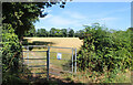
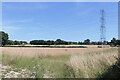

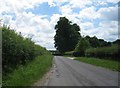
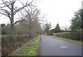
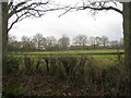
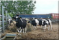
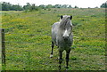
22 photos from this area
Area Information
Key information about the RG26 5SE including its size, population, and administrative classification.
- Area Type
- Postcode
- Area Size
- 43.1 hectares
- Population
- 1354
- Population Density
- 153 people/km²
House Prices in RG26 5SE
10
Properties
£995,000
Average Sold Price
£650,000
Lowest Price
£1,340,000
Highest Price
Showing 10 properties
| Address | Type | Beds | Baths | Last Sale Price | Last Sale Date | |
|---|---|---|---|---|---|---|
| Devonia, Deans Lane, Charter Alley, RG26 5SE | Bungalow | 4 | 2 | £650,000 | Nov 2014 | |
| Brae Lea, Deans Lane, Charter Alley, RG26 5SE | Detached | 5 | 5 | £1,340,000 | Jul 2008 | |
| Caravan, Witch Lane Farm, Deans Lane, Charter Alley, RG26 5SE | Mobile Home | - | - | - | - | |
| Annexe At, Witch Lane Cottage, Deans Lane, Charter Alley, RG26 5SE | Semi-detached | - | - | - | - | |
| Unit 3, Witch Lane Farm, Deans Lane, Charter Alley, RG26 5SE | Farm | - | - | - | - | |
| G And D Steel And Fabrication Ltd, Unit 2, Witch Lane Farm, Deans Lane, Charter Alley, RG26 5SE | warehouse | - | - | - | - | |
| Plantation Cottage, Deans Lane, Charter Alley, RG26 5SE | Detached | - | - | - | - | |
| Witch Lane Farm, Deans Lane, Charter Alley, RG26 5SE | Detached | - | - | - | - | |
| Little Wyford Farm, Deans Lane, Charter Alley, RG26 5SE | Detached | - | - | - | - | |
| Witch Lane Cottage, Deans Lane, Charter Alley, RG26 5SE | house | - | - | - | - |
Energy Efficiency in RG26 5SE
Amenities
Schools
| Rank | School | Type | Entry gender | Ages |
|---|
Explore more schools in this area
Go to Schools tabDemographics
Household Size
Two person
most common
Accommodation Type
Houses
most common
Tenure
85
majority
Ethnic Group
White
most common
Religion
N/A
most common
Household Composition
N/A
most common
Age
47
median
Adults (30-64 years)
most common
Household Deprivation
N/A
with no deprivation
NS-SEC
46
in Lower managerial occupations
Explore more demographic insights in this area
Go to Demographics tabPlanning
Planning Constraints
- Flood RiskPremium
- Ramsar Wetland SitesPremium
- Area of Outstanding Natural BeautyPremium
- Protected Nature ReservePremium
- Protected WoodlandPremium