Area Overview for RG26 5SA
Photos of RG26 5SA

Area Information
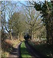
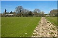
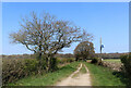
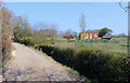
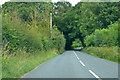
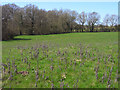
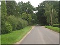
Living in RG26 5SA offers access to a defined residential cluster spanning 1.3 square kilometres. The area hosts a population of 1,786 residents across this compact footprint, creating a setting where neighbours are likely to know one another. You reside within a predominantly suburban environment characterised by detached and semi-detached houses. The demographic profile suggests a mature community, with 47 serving as the median age and adults aged between 30 and 64 years forming the majority of the population. This snapshot indicates a neighbourhood focused on established families and steady households rather than rapid turnover. Safety profiles for the postcode are generally positive, with low risk assessments across most categories. You benefit from a quiet location that avoids the constraints of protected nature reserves, Ramsar sites, or Areas of Outstanding Natural Beauty. While some protected woodland exists nearby, the overall environment remains stable and predictable. Daily life centres on practical convenience, with rail links and retail options positioned within a short journey. The demographics point toward a stable population base where long-term residency is common.
- Area Type
- Postcode
- Area Size
- 1.3 km²
- Population
- 1786
- Population Density
- 66 people/km²
The property market in RG26 5SA is defined by a strong owner-occupier base, with 77% of households owning their homes. This high percentage indicates that the area is not a rental hot spot but rather a destination for people building long-term roots. The predominant accommodation type is houses, which means you will find a landscape dominated by detached or semi-detached properties rather than flatted urban living. Buyers here should expect a traditional suburban housing stock suitable for families requiring gardens and driveway space. Because ownership is so common, rental yields might be lower than in areas with higher tenancy rates, yet capital stability is often higher due to resident inertia. The small size of the area, at just 1.3 square kilometres, limits the total inventory available at any given moment. This scarcity can drive competition when specific desirable homes become available. Commuters working from nearby professional hubs will appreciate the house types which often offer better property values than smaller urban apartments. You do not find the concentration of social housing that might characterise larger council estates. Instead, the market operates with a focus on private investment and family settlement patterns.
House Prices in RG26 5SA
Showing 24 properties
| Address | Type | Beds | Baths | Last Sale Price | Last Sale Date | |
|---|---|---|---|---|---|---|
| The Smiths, Wheathold, Wolverton, RG26 5SA | Detached | 4 | 2 | £925,000 | Dec 2020 | |
| Batson Cottage, Wheathold, Wolverton, RG26 5SA | Detached | 4 | 2 | £480,000 | Jun 2018 | |
| Wheathold Place, Wheathold, Wolverton, RG26 5SA | house | 6 | - | £2,950,000 | Dec 2011 | |
| Wheathold House, Wheathold, Wolverton, RG26 5SA | Detached | - | - | £800,000 | Mar 2005 | |
| Wheathold Edge, Wheathold, Wolverton, RG26 5SA | Detached | - | - | £700,000 | Jul 2002 | |
| Wheat House, Wheathold, Wolverton, RG26 5SA | Detached | - | - | £675,000 | Sep 1998 | |
| Wheathold Cottage, Wheathold, Wolverton, RG26 5SA | Detached | 6 | 5 | - | - | |
| 1, Cannon Stable Cottages, Wheathold, Wolverton, RG26 5SA | Semi-detached | 5 | 3 | - | - | |
| 2, Cannon Stable Cottages, Wheathold, Wolverton, RG26 5SA | Semi-detached | 6 | 3 | - | - | |
| Green Lane Cottage, Wheathold, Wolverton, RG26 5SA | house | 5 | - | - | - |
Energy Efficiency in RG26 5SA
Your daily life in RG26 5SA is supported by five notable retail outlets within practical reach. You can shop at Tesco Baughurst for groceries, visit Budgens Kingsclere for essentials, or use The Southern Co-operative Co for local provisions. These venues provide the core shopping needs for households without necessitating long journeys into town centres. Railway access is equally convenient, with five stations located nearby including Midgham Railway Station, Thatcham Railway Station, and Aldermaston Railway Station. This rail network offers direct links to Reading and the wider national rail system, facilitating easy commutes for work or leisure travel. You have immediate access to supermarkets and public transport nodes from your doorstep. The concentration of these amenities minimises the need for a personal vehicle for routine supermarket runs or postal deliveries. Life here balances the quietude of residential streets with the convenience of established high street services nearby. Shopping trips and train journeys are short enough to fit easily into a weekend schedule. You enjoy a lifestyle where necessary services are present and accessible without the congestion of larger urban districts.
Amenities
Schools
Families residing in RG26 5SA have access to Ashford Hill Primary School, a state-funded institution located close to the postcode. The area is also proximate to Cheam School, an independent establishment providing an alternative educational pathway for those seeking private education options. The presence of two distinct school types within practical reach allows you to choose between state and independent education for your children. Ashford Hill Primary School serves the local catchment, while Cheam School typically requires its own admissions process and may draw from a wider radius. The mix of these institutions indicates that the neighbourhood supports various educational philosophies and budgetary preferences. You can find state education options that are directly accessible without long commutes. Independent schooling is represented here, giving parents flexibility in curriculum choice and boarding options if needed. The proximity of these schools is a significant factor for families deciding where to purchase a home. While specific Ofsted ratings are not listed in the current dataset, the availability of both primary-level state and independent schools suggests a mature educational infrastructure for the RG26 5SA postcode.
| Rank | School | Type | Entry gender | Ages |
|---|
Explore more schools in this area
Go to Schools tabDemographics
The community in RG26 5SA reflects a settled population with a median age of 47 years. Adults between 30 and 64 years account for the most common age range, indicating that families and those approaching retirement form the core of the social fabric. Home ownership stands at 77%, confirming that the vast majority of residents own their properties outright or via mortgage rather than renting. This figure creates a stable housing stock where investment tends to remain in the status quo rather than fluctuating rapidly due to market speculation. The prevailing accommodation type consists of houses, which aligns with the high ownership rate and implies substantial front gardens and private outdoor space. Most residents identify as White, reinforcing the traditional demographic composition of the broader Reading and Berkshire region. Deprivation metrics are not explicitly detailed in the available statistics, but the high rate of employment typically associated with this age group suggests a robust local economy. You find little evidence of transient populations within the immediate vicinity, meaning you can expect consistent neighbours across the housing lanes. This stability is often prized by those seeking a quiet domestic environment away from commercial pressures.
Household Size
Accommodation Type
Tenure
Ethnic Group
Religion
Household Composition
Age
Household Deprivation
NS-SEC
Explore more demographic insights in this area
Go to Demographics tabPlanning
Planning Constraints
- Flood RiskPremium
- Ramsar Wetland SitesPremium
- Area of Outstanding Natural BeautyPremium
- Protected Nature ReservePremium
- Protected WoodlandPremium