Area Overview for RG26 5EL
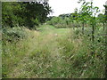
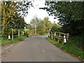
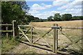
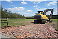
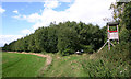
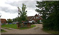
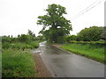
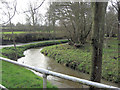
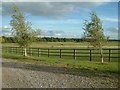
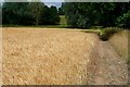
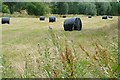
Photos of RG26 5EL

Area Information
Living in RG26 5EL means residing within a compact residential cluster covering 16.3 hectares in England. This specific postcode area accommodates a population of 1,365 residents, resulting in a low population density of 80 people per square kilometre. The layout is designed primarily for suburban living, offering a quiet environment rather than the high-energy pace found in larger towns. You will find that daily life here revolves around a close-knit community where neighbours know one another, supported by a housing stock dominated by houses. The area provides a peaceful retreat while maintaining practical access to essential services spread across nearby towns. Families and individuals seeking a lower-density lifestyle appreciate the spacious feel that such a small footprint creates. Every street offers a sense of tranquillity, making it an attractive option for those prioritising calm over urban convenience. The small size ensures that the community remains tightly integrated, reducing travel times between local spots and fostering a rural-suburban blend.
- Area Type
- Postcode
- Area Size
- 16.3 hectares
- Population
- 1365
- Population Density
- 80 people/km²
RG26 5EL operates primarily as an area for owner-occupied homes, influenced heavily by a home ownership rate of 77%. The housing stock consists almost exclusively of houses, offering a distinct contrast to flat-heavy urban centres. This dominance of households means buyers looking to purchase in this postcode will encounter detached, semi-detached, or terraced properties rather than high-rise blocks. The low density of 80 people per square kilometre supports a market where property prices reflect the availability of land and garden space. While specific sale prices are not detailed here, the structural nature of the market suggests stability driven by local demand from owner-occupiers. Renters constitute a small minority of the 1365 residents, reducing vacancy rates and keeping the neighbourhood character consistent. Families buying homes in RG26 5EL typically seek single-level living or properties with curtilage, fitting the established pattern of the local real estate landscape.
House Prices in RG26 5EL
Showing 8 properties
| Address | Type | Beds | Baths | Last Sale Price | Last Sale Date | |
|---|---|---|---|---|---|---|
| Frith View, Ash Lane, Little London, RG26 5EL | Bungalow | 3 | - | - | - | |
| Bournebrook House, Ash Lane, Little London, RG26 5EL | Detached | - | - | - | - | |
| Bournebrook Lodge, Ash Lane, Little London, RG26 5EL | Bungalow | - | - | - | - | |
| The Barn, Ash Lane, Little London, RG26 5EL | Bungalow | - | - | - | - | |
| Haines Farm, Ash Lane, Little London, RG26 5EL | Industrial | - | - | - | - | |
| Haines Farm House, Ash Lane, Little London, RG26 5EL | house | - | - | - | - | |
| Wheatlands, Ash Lane, Little London, RG26 5EL | Detached | 4 | 3 | - | - | |
| Maybank, Ash Lane, Little London, RG26 5EL | Detached | - | - | - | - |
Energy Efficiency in RG26 5EL
Residents of RG26 5EL enjoy convenient access to essential retail and rail services within practical reach. Local shopping needs are met by venues including Morrisons Daily, Co-op Tadley, and Asda Tadley, located in nearby estates. These supermarkets provide full-range groceries and daily essentials, reducing the need for long journeys to town centres. Travel connectivity relies on five identified railway stations, specifically Bramley Railway Station, Mortimer Railway Station, and Basingstoke Railway Station. These rail links connect you to wider job markets, allowing commuters to access Basingstoke or London via established routes. The availability of these specific stations means travel time remains manageable for those working outside the immediate hamlet. Daily life balances self-sufficiency through local shops with the mobility offered by the railway network. You can walk or drive easily to these named amenities without facing significant traffic congestion.
Amenities
Schools
Parental options for education are anchored by Silchester Church of England Primary School, which holds a Good overall Ofsted rating. This primary institution serves as the main educational resource for younger children within the immediate vicinity of RG26 5EL. The presence of a single listed primary school with a Good rating indicates a reliable foundational education option for families moving to this postcode. Secondary education details are not included in the provided dataset for this specific area, so you should verify high school provision nearby. The school's status as a Church of England academy may appeal to families valuing a faith-based curriculum alongside academic instruction. Proximity to this rated school enhances the attractiveness of homes in RG26 5EL for parents with school-age children. The Good rating confirms that the institution meets national standards for education and behaviour.
| Rank | School | Type | Entry gender | Ages |
|---|
Explore more schools in this area
Go to Schools tabDemographics
The community within RG26 5EL reflects a mature demographic profile with a median age of 47 years. The majority of residents fall into the adult age range between 30 and 64 years, suggesting a population stabilised by families approaching retirement or active careers. Home ownership stands high at 77%, indicating that most households have significant stake in the local property market rather than relying on the private rental sector. Houses form the predominant accommodation type, aligning with the desire for long-term stability and garden space. The population is predominantly White, mirroring the broader regional trends of the area. This demographic composition creates a stable neighbourhood environment where long-term residents often remain for generations. The high ownership rate implies lower transience and a community invested in the quality and maintenance of local streets. You will encounter residents who value independence and security, characteristics typical of this age group and ownership profile.
Household Size
Accommodation Type
Tenure
Ethnic Group
Religion
Household Composition
Age
Household Deprivation
NS-SEC
Explore more demographic insights in this area
Go to Demographics tabPlanning
Planning Constraints
- Flood RiskPremium
- Ramsar Wetland SitesPremium
- Area of Outstanding Natural BeautyPremium
- Protected Nature ReservePremium
- Protected WoodlandPremium