Area Overview for RG26 3NY
Photos of RG26 3NY


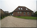
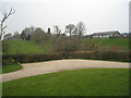
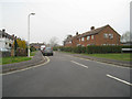
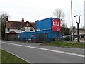


27 photos from this area
Area Information
Key information about the RG26 3NY including its size, population, and administrative classification.
- Area Type
- Postcode
- Area Size
- 2.2 hectares
- Population
- 1247
- Population Density
- 1839 people/km²
House Prices in RG26 3NY
18
Properties
£472,264
Average Sold Price
£202,500
Lowest Price
£730,000
Highest Price
Showing 18 properties
| Address | Type | Beds | Baths | Last Sale Price | Last Sale Date | |
|---|---|---|---|---|---|---|
| Kingswood House, Malthouse Lane, Tadley, RG26 3NY | Detached | 4 | 2 | £730,000 | May 2025 | |
| Tanglewood, Malthouse Lane, Tadley, RG26 3NY | house | - | - | £650,000 | Aug 2021 | |
| Crooked Cottage, Malthouse Lane, Tadley, RG26 3NY | Detached | 4 | 2 | £685,000 | Jun 2021 | |
| Rose Cottage, 9 Malthouse Lane, Tadley, RG26 3NY | Semi-detached | 3 | 1 | £445,000 | Sep 2020 | |
| Ashdown Cottage, 4 Malthouse Lane, Tadley, RG26 3NY | Detached | 4 | 1 | £540,000 | Oct 2018 | |
| Tandanya, Malthouse Lane, Tadley, RG26 3NY | Detached | 3 | 1 | £460,500 | Jul 2018 | |
| The Woodlands, Malthouse Lane, Tadley, RG26 3NY | Detached | 4 | - | £460,000 | Feb 2015 | |
| Chine Cottage, Malthouse Lane, Tadley, RG26 3NY | house | 4 | - | £358,900 | May 2011 | |
| Byron House, Malthouse Lane, Tadley, RG26 3NY | Detached | - | - | £430,000 | Aug 2007 | |
| Old Malthouse, Malthouse Lane, Tadley, RG26 3NY | Detached | 4 | 2 | £233,000 | Jul 1998 |
Page 1 of 2
Energy Efficiency in RG26 3NY
Amenities
Schools
| Rank | School | Type | Entry gender | Ages |
|---|
Explore more schools in this area
Go to Schools tabDemographics
Household Size
Two person
most common
Accommodation Type
Houses
most common
Tenure
85
majority
Ethnic Group
White
most common
Religion
N/A
most common
Household Composition
N/A
most common
Age
47
median
Adults (30-64 years)
most common
Household Deprivation
N/A
with no deprivation
NS-SEC
46
in Lower managerial occupations
Explore more demographic insights in this area
Go to Demographics tabPlanning
Planning Constraints
- Flood RiskPremium
- Ramsar Wetland SitesPremium
- Area of Outstanding Natural BeautyPremium
- Protected Nature ReservePremium
- Protected WoodlandPremium