Area Overview for RG25 3NE
Photos of RG25 3NE
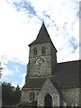
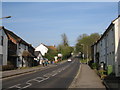
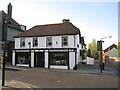
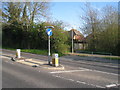
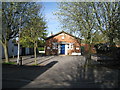
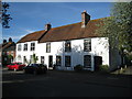
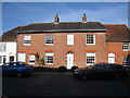
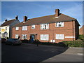
100 photos from this area
Area Information
Key information about the RG25 3NE including its size, population, and administrative classification.
- Area Type
- Postcode
- Area Size
- 6.4 hectares
- Population
- 1610
- Population Density
- 1895 people/km²
House Prices in RG25 3NE
11
Properties
£454,000
Average Sold Price
£130,000
Lowest Price
£705,500
Highest Price
Showing 11 properties
| Address | Type | Beds | Baths | Last Sale Price | Last Sale Date | |
|---|---|---|---|---|---|---|
| 56 Waltham Road, Overton, RG25 3NE | Bungalow | 4 | 3 | £705,500 | Nov 2022 | |
| 51 Waltham Road, Overton, RG25 3NE | Bungalow | 4 | 4 | £590,000 | Aug 2021 | |
| Near Hope, 54A Waltham Road, Overton, RG25 3NE | house | - | - | £477,500 | Jul 2016 | |
| Gatewood, 58 Waltham Road, Overton, RG25 3NE | house | - | - | £663,000 | Jul 2015 | |
| 50 Waltham Road, Overton, RG25 3NE | Terraced | 3 | 2 | £310,000 | Oct 2014 | |
| Oak House, 53 Waltham Road, Overton, RG25 3NE | Detached | 4 | 3 | £595,000 | Jul 2014 | |
| 52A Waltham Road, Overton, RG25 3NE | Semi-detached | - | - | £265,000 | Oct 2007 | |
| Crillon, 54 Waltham Road, Overton, RG25 3NE | Detached | - | - | £350,000 | Jun 2006 | |
| 52 Waltham Road, Overton, RG25 3NE | house | 3 | - | £130,000 | Nov 2001 | |
| Keystone, 56A Waltham Road, Overton, RG25 3NE | house | - | - | - | - |
Page 1 of 2
Energy Efficiency in RG25 3NE
Amenities
Schools
| Rank | School | Type | Entry gender | Ages |
|---|
Explore more schools in this area
Go to Schools tabDemographics
Household Size
Two person
most common
Accommodation Type
Houses
most common
Tenure
67
majority
Ethnic Group
White
most common
Religion
N/A
most common
Household Composition
N/A
most common
Age
47
median
Adults (30-64 years)
most common
Household Deprivation
N/A
with no deprivation
NS-SEC
41
in Lower managerial occupations
Explore more demographic insights in this area
Go to Demographics tabPlanning
Planning Constraints
- Flood RiskPremium
- Ramsar Wetland SitesPremium
- Area of Outstanding Natural BeautyPremium
- Protected Nature ReservePremium
- Protected WoodlandPremium