Area Overview for RG25 3BD
Photos of RG25 3BD
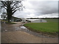
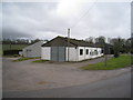
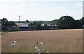
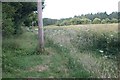
100 photos from this area
Area Information
Key information about the RG25 3BD including its size, population, and administrative classification.
- Area Type
- Postcode
- Area Size
- 1.1 km²
- Population
- 1712
- Population Density
- 30 people/km²
House Prices in RG25 3BD
11
Properties
£1,462,500
Average Sold Price
£1,325,000
Lowest Price
£1,600,000
Highest Price
Showing 11 properties
| Address | Type | Beds | Baths | Last Sale Price | Last Sale Date | |
|---|---|---|---|---|---|---|
| Patience House, Ashe Park Lane, Steventon, RG25 3BD | Bungalow | - | - | £1,600,000 | Mar 2014 | |
| Nuns Walk Cottage, Stubbs Hill, Steventon, RG25 3BD | house | - | - | £1,325,000 | Nov 2010 | |
| Steventon Childrens House, Steventon Village Hall, Ashe Park Lane, Steventon, RG25 3BD | commercial | - | - | - | - | |
| Palace International Ltd, The Barn, Stoken Farm, Stubbs Hill, Steventon, RG25 3BD | Industrial | - | - | - | - | |
| Cucina Kitchens, Offices Unit 2, Stoken Place, Stubbs Hill, Steventon, RG25 3BD | Office | - | - | - | - | |
| Gravelly Bottom House, Stubbs Hill, Steventon, RG25 3BD | Detached | - | - | - | - | |
| Cucina Commercial Ltd, Unit 2, Stoken Place, Stubbs Hill, Steventon, RG25 3BD | Office | - | - | - | - | |
| Red Radish, Number 1 Eastern Barn, Stoken Farm, Stubbs Hill, Steventon, RG25 3BD | office_workshop | - | - | - | - | |
| Gravelly Bottom Bungalow, Stubbs Hill, Steventon, RG25 3BD | Bungalow | 3 | 1 | - | - | |
| Stoken Farm House, Stubbs Hill, Steventon, RG25 3BD | Detached | - | - | - | - |
Page 1 of 2
Energy Efficiency in RG25 3BD
Amenities
Schools
| Rank | School | Type | Entry gender | Ages |
|---|
Explore more schools in this area
Go to Schools tabDemographics
Household Size
Two person
most common
Accommodation Type
Houses
most common
Tenure
68
majority
Ethnic Group
White
most common
Religion
N/A
most common
Household Composition
N/A
most common
Age
47
median
Adults (30-64 years)
most common
Household Deprivation
N/A
with no deprivation
NS-SEC
50
in Lower managerial occupations
Explore more demographic insights in this area
Go to Demographics tabPlanning
Planning Constraints
- Flood RiskPremium
- Ramsar Wetland SitesPremium
- Area of Outstanding Natural BeautyPremium
- Protected Nature ReservePremium