Area Overview for RG25 2RP
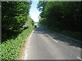
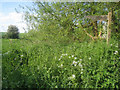
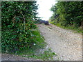
Photos of RG25 2RP

Area Information
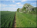
RG25 2RP represents a compact residential cluster covering 15.8 hectares in the heart of England. This specific postcode area accommodates a population of 1,196 residents, resulting in a low density of 65 people per square kilometre. The setting offers a quiet environment suitable for those seeking a community with space. Living in RG25 2RP means navigating a locality defined by its manageable size and intimate feel rather than high-rise density. Your daily routine involves a close-knit neighbourhood where the land use is predominantly residential. The area functions as a small community unit within the broader administrative framework of the postcode. You are situated in a setting where traffic volume correlates directly with the smaller population base. This demographic profile creates a predictable environment for families and individuals prioritising calm surroundings. The physical boundaries of the 15.8 hectares hold the entire local community together. Residents experience a defined sense of place that distinguishes this postcode from larger urban sprawls.
- Area Type
- Postcode
- Area Size
- 15.8 hectares
- Population
- 1196
- Population Density
- 65 people/km²
The property market in RG25 2RP is fundamentally an owner-occupied domain. With 69% of households owning their homes, the market dynamics shift away from the volatility often seen in high-yield rental sectors. You are likely to encounter a range of house types given the accommodation type is listed solely as houses. This predominance of houses indicates that demand focuses on detached, semi-detached, or terraced family properties. Buyers looking at homes in RG25 2RP should prioritise traditional house formats over converted flats or purpose-built rentals. The low population density of 65 people per square kilometre supports single-family dwellings rather than high-density developments. Your search will naturally filter towards properties with gardens and direct access to outside space. The 15.8 hectares of land available for this postcode cluster limits the supply of new builds significantly. Expect a market driven by existing stock appreciation rather than new construction launches. This stability benefits sellers with established equity and buyers seeking traditional living arrangements.
House Prices in RG25 2RP
Showing 4 properties
| Address | Type | Beds | Baths | Last Sale Price | Last Sale Date | |
|---|---|---|---|---|---|---|
| Ford Farm House, Ford Lane, Upton Grey, Basingstoke, RG25 2RP | farmhouse | 2 | 1 | £760,000 | May 2004 | |
| The Annexe, Ford Farm, Ford Lane, Upton Grey, Basingstoke, RG25 2RP | house | - | - | - | - | |
| 2, Ford Farm Cottage, Ford Lane, Upton Grey, Basingstoke, RG25 2RP | Semi-detached | - | - | - | - | |
| 1, Ford Farm Cottage, Ford Lane, Upton Grey, Basingstoke, RG25 2RP | Semi-detached | 4 | - | - | - |
Energy Efficiency in RG25 2RP
Daily life for residents of RG25 2RP balances convenience with proximity to essential services. Your nearest retail options include The Southern Co-operative Co, Tesco Hook, and Budgens Hook. These five retail outlets provide standard grocery and household shopping within a short drive or local bus journey. For transport, three railway stations offer rail connections: Hook, Winchfield, and Basingstoke. Using these stations allows you to integrate into wider regional networks easily. Two airports lie nearby, identified as RAF Odiham and Lasham Airport. This dual airport presence provides flexibility for leisure travel or business flights. You have access to seven nearby amenities spread across these categories. The presence of Tesco and Budgens supports a self-sufficient lifestyle where you rarely travel far for basic needs. The area supports a practical routine where residents work efficiently with reliable transport links. Your lifestyle integrates these seven amenities seamlessly into your weekly schedule. Travel times to these specific venues remain manageable given the area's small population base.
Amenities
Schools
Families in RG25 2RP have access to specific educational institutions within practical reach. The most prominent option listed is Lord Wandsworth College, an independent school. This school type offers an alternative to the state-maintained system typically found in local authorities. Choosing independent education requires careful consideration of the school's distinct curriculum and fee structure. You currently have no data regarding Ofsted ratings for this establishment in the provided figures, so verification is essential before making commitments. The presence of an independent school suggests the area attracts families who prioritise specific educational philosophies or exclusivity. Standard primary and secondary schools are notably absent from the immediate list, meaning you plan your commute beyond the immediate neighbourhood for state education. Commissioning research on nearby state schools would be a prudent next step for your family planning. The education supply here relies heavily on proximity to the area plus independent choices. Your attendance zones will depend on enrolment numbers at Lord Wandsworth College and admission criteria.
| Rank | School | Type | Entry gender | Ages |
|---|
Explore more schools in this area
Go to Schools tabDemographics
The community within RG25 2RP is characterised by substantial stability and maturity. The median age stands at 47 years, indicating a population dominated by adults. More than half of the residents fall within the 30 to 64 years age range. This demographic split suggests the area appeals primarily to families and established couples rather than young singles or empty-nesters. Home ownership reflects this settled nature, with 69% of households owning their property outright or with a mortgage. The remaining 31% typically comprise private renters or shared owners. Housing stock consists almost entirely of houses, aligning with the preference for family-friendly accommodation over flats. The area is predominantly White, reflecting standard regional composition. You should expect a neighbourhood where long-term residents are common and transient populations remain low. This ownership profile implies steady demand from current and potential homeowners rather than a high turnover rental market. The housing subsidies are likely lower given the high rates of private ownership. Your investment here targets security and longevity rather than speculative short-term gains.
Household Size
Accommodation Type
Tenure
Ethnic Group
Religion
Household Composition
Age
Household Deprivation
NS-SEC
Explore more demographic insights in this area
Go to Demographics tabPlanning
Planning Constraints
- Flood RiskPremium
- Ramsar Wetland SitesPremium
- Area of Outstanding Natural BeautyPremium
- Protected Nature ReservePremium
- Protected WoodlandPremium